Area Overview for BH13 6AS
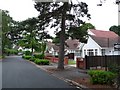
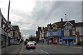
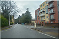
Photos of BH13 6AS

Area Information
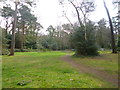
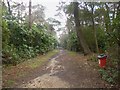
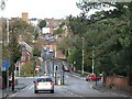
BH13 6AS is a small residential postcode in Poole, Dorset, encompassing parts of Canford Cliffs and Sandbanks. With a population of 1,837 spread over 1.5 hectares, it is a densely populated area where 1,642 people live per square kilometre. The community is rooted in Victorian-era development, established in 1886 on land once owned by Lord Wimborne. Originally designed as a seaside retreat for affluent buyers, the area evolved into a mix of permanent homes, holiday flats, and second residences. Today, it retains its coastal charm with cliffs, chines, and watersports facilities, particularly sail boarding, which thrives in the shallow harbour waters. The ward is split between Bournemouth West and Poole constituencies, reflecting its proximity to both towns. Daily life here is shaped by proximity to the sea, historic landmarks like the Martello Tower, and a blend of modern and heritage architecture. While the population is predominantly middle-aged adults, the area’s character is defined by its residential focus and limited commercial development, making it a quiet, seaside enclave.
- Area Type
- Postcode
- Area Size
- 1.5 hectares
- Population
- 1837
- Population Density
- 1642 people/km²
The property market in BH13 6AS is dominated by flats, with 69% of residents owning their homes. This suggests a strong owner-occupied market, though the small area size and limited housing stock indicate a constrained supply. The original Victorian and Edwardian properties have been largely replaced by modern blocks of flats, reflecting a trend towards higher-density development. This shift has made the area more accessible to buyers seeking affordable, well-maintained housing in a seaside location. However, the prevalence of flats may limit options for those preferring larger homes or detached properties. The market is also influenced by the area’s status as a holiday letting hub, with many properties serving dual purposes as second homes. Buyers should consider the competitive nature of the market and the potential for fluctuating demand due to seasonal tourism.
House Prices in BH13 6AS
Showing 2 properties
| Address | Type | Beds | Baths | Last Sale Price | Last Sale Date | |
|---|---|---|---|---|---|---|
| Livability Horizons, Victoria Care Home, 12 Lindsay Road, Poole, BH13 6AS | Retirement | - | - | - | - | |
| Victoria Education Centre, 12 Lindsay Road, Poole, BH13 6AS | commercial | - | - | - | - |
Energy Efficiency in BH13 6AS
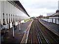
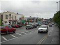
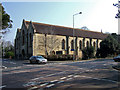
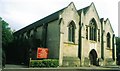
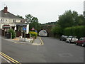
Living in BH13 6AS offers a blend of coastal living and practical amenities. Nearby, residents can shop at Lidl Parkstone, Tesco Poole, and M&S Westbourne SF, while rail stations like Branksome and Parkstone provide access to urban centres. The area’s proximity to Sandbanks Ferry Terminal and Brownsea Island Ferry Landing enhances its appeal for watersports enthusiasts, with sail boarding thriving in the shallow harbour. Historic sites such as Holy Angels Church and the Martello Tower add cultural depth, and the cliffs and chines offer scenic walks. The mix of retail, transport, and leisure options ensures a convenient lifestyle, though the small area size means some amenities require a short journey to nearby towns.
Amenities
Schools
The nearest school to BH13 6AS is Victoria Education Centre, a special school catering to students with specific educational needs. No other schools are listed in the data, which means families may need to look beyond the immediate area for mainstream primary or secondary education. The presence of a special school suggests the community includes households with children requiring tailored support, but the absence of other schools indicates a reliance on nearby towns like Bournemouth or Poole for broader educational options. Parents should investigate transport links and school catchment areas beyond BH13 6AS to ensure access to a full range of educational institutions.
| Rank | School | Type | Entry gender | Ages |
|---|
Explore more schools in this area
Go to Schools tabDemographics
The median age in BH13 6AS is 47, with the majority of residents aged 30–64. This suggests a mature, stable community with a strong presence of middle-aged households. Home ownership is high at 69%, indicating a significant number of long-term residents. The primary accommodation type is flats, reflecting the area’s original estate planning and subsequent shift towards higher-density housing. The predominant ethnic group is White, and the population density of 1,642 people per square kilometre highlights a compact, closely knit community. This density, combined with the age profile, implies a mix of families and retirees, with limited presence of younger or older demographics. The lack of specific data on deprivation means the area’s quality of life is inferred from its amenities and safety profile, which are otherwise well-documented.
Household Size
Accommodation Type
Tenure
Ethnic Group
Religion
Household Composition
Age
Household Deprivation
NS-SEC
Explore more demographic insights in this area
Go to Demographics tabPlanning
Planning Constraints
- Flood RiskPremium
- Ramsar Wetland SitesPremium
- Area of Outstanding Natural BeautyPremium
- Protected Nature ReservePremium
- Protected WoodlandPremium