Area Overview for BA4 6EA
Photos of BA4 6EA
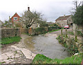
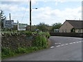
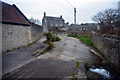
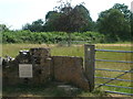
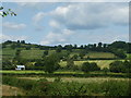
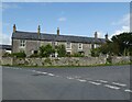
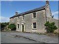
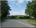
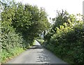
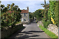
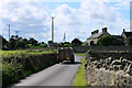
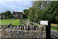
26 photos from this area
Area Information
Key information about the BA4 6EA including its size, population, and administrative classification.
- Area Type
- Postcode
- Area Size
- 36.8 hectares
- Population
- 1570
- Population Density
- 77 people/km²
House Prices in BA4 6EA
24
Properties
£369,000
Average Sold Price
£64,000
Lowest Price
£1,050,000
Highest Price
Showing 24 properties
| Address | Type | Beds | Baths | Last Sale Price | Last Sale Date | |
|---|---|---|---|---|---|---|
| Bartons, Back Lane, Stoney Stratton, Shepton Mallet, BA4 6EA | house | 3 | 1 | £460,000 | Oct 2021 | |
| The Malthouse, Back Lane, Stoney Stratton, Shepton Mallet, BA4 6EA | house | - | - | £267,500 | Jun 2021 | |
| Edreston House, Back Lane, Stoney Stratton, Shepton Mallet, BA4 6EA | house | - | - | £615,000 | Jun 2017 | |
| Rock Farm, Back Lane, Stoney Stratton, Shepton Mallet, BA4 6EA | Detached | 5 | 3 | £1,050,000 | Mar 2017 | |
| Cobwebs, Back Lane, Stoney Stratton, Shepton Mallet, BA4 6EA | Bungalow | 4 | - | £615,000 | Sep 2015 | |
| Piglet Cottage, Back Lane, Stoney Stratton, Shepton Mallet, BA4 6EA | Terraced | - | - | £132,500 | Nov 2014 | |
| Parsonage House, Back Lane, Stoney Stratton, Shepton Mallet, BA4 6EA | house | - | - | £840,000 | Jan 2011 | |
| Field Cottage, Back Lane, Stoney Stratton, Shepton Mallet, BA4 6EA | Detached | - | - | £378,000 | Oct 2007 | |
| The Lost Chapel, Back Lane, Stoney Stratton, Shepton Mallet, BA4 6EA | Terraced | - | - | £173,000 | May 2004 | |
| The Towers, Back Lane, Stoney Stratton, Shepton Mallet, BA4 6EA | Semi-detached | - | - | £145,000 | Sep 2000 |
Page 1 of 3
Energy Efficiency in BA4 6EA
Amenities
Schools
| Rank | School | Type | Entry gender | Ages |
|---|
Explore more schools in this area
Go to Schools tabDemographics
Household Size
Two person
most common
Accommodation Type
Houses
most common
Tenure
77
majority
Ethnic Group
White
most common
Religion
N/A
most common
Household Composition
N/A
most common
Age
47
median
Adults (30-64 years)
most common
Household Deprivation
N/A
with no deprivation
NS-SEC
35
in Lower managerial occupations
Explore more demographic insights in this area
Go to Demographics tabPlanning
Planning Constraints
- Flood RiskPremium
- Ramsar Wetland SitesPremium
- Area of Outstanding Natural BeautyPremium
- Protected Nature ReservePremium
- Protected WoodlandPremium