Area Overview for BA4 6EE
Photos of BA4 6EE
Area Information
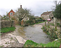
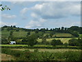
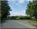
BA4 6EE is a small residential postcode area in North East Somerset, encompassing the village of Evercreech and its surrounding hamlets. With a population of 1,570 and a density of 77 people per square kilometre, it is a quiet, low-density community. Situated between Shepton Mallet and Bruton, the area is steeped in history, with Saxon origins and archaeological sites like the Bronze Age camp at Chesterblade. Modern residents benefit from low flood risk and a safety score of 80/100, indicating a secure neighbourhood. The village blends rural charm with practical connectivity, including two nearby railway stations and a modest retail presence. Daily life here is characterised by a close-knit community, historical landmarks, and a tranquil environment, making it appealing to those seeking a balance between heritage and convenience.
- Area Type
- Postcode
- Area Size
- Not available
- Population
- 1570
- Population Density
- 77 people/km²
House Prices in BA4 6EE
No properties found in this postcode.
Energy Efficiency in BA4 6EE
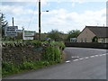
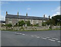
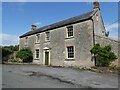
The lifestyle in BA4 6EE is shaped by its small-scale amenities and rural setting. Within practical reach, residents can access five retail outlets, including the Co-op Evercreech and Spar, offering essential shopping needs. The village’s historical character is complemented by its proximity to Bruton and Castle Cary stations, which provide access to larger towns for additional services. While the area lacks large-scale leisure facilities, its low population density and historical sites, such as St Peter’s Church and the Bronze Age hill fort, contribute to a distinct, heritage-rich environment. The combination of practical retail options and easy rail access ensures a self-contained yet connected lifestyle, ideal for those valuing tranquillity without sacrificing convenience.
Amenities
Schools
The nearest school to BA4 6EE is Evercreech Church of England Primary School, which serves the local community with primary education. While no secondary schools are listed in the data, the presence of a primary school ensures that young families have access to foundational education. The single primary school suggests a focused, community-oriented approach to schooling, though parents seeking a broader range of educational options may need to look to nearby towns like Bruton or Castle Cary. The school’s role as a central institution underscores the village’s commitment to nurturing its younger population.
| Rank | School | Type | Entry gender | Ages |
|---|
Explore more schools in this area
Go to Schools tabDemographics
Household Size
Accommodation Type
Tenure
Ethnic Group
Religion
Household Composition
Age
Household Deprivation
NS-SEC
Explore more demographic insights in this area
Go to Demographics tabPlanning
Planning Constraints
- Flood RiskPremium
- Ramsar Wetland SitesPremium
- Area of Outstanding Natural BeautyPremium
- Protected Nature ReservePremium
- Protected WoodlandPremium