Area Overview for BA22 9SF
Photos of BA22 9SF
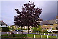
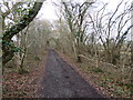
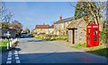
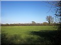
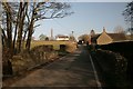
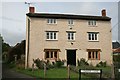

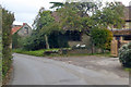
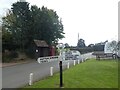
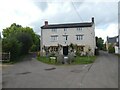
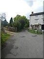
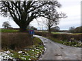
25 photos from this area
Area Information
Key information about the BA22 9SF including its size, population, and administrative classification.
- Area Type
- Postcode
- Area Size
- 30.5 hectares
- Population
- 1871
- Population Density
- 25 people/km²
House Prices in BA22 9SF
17
Properties
£403,408
Average Sold Price
£100,000
Lowest Price
£875,000
Highest Price
Showing 17 properties
| Address | Type | Beds | Baths | Last Sale Price | Last Sale Date | |
|---|---|---|---|---|---|---|
| Five Acres, Common Lane, Halstock, BA22 9SF | Detached | 4 | 2 | £647,500 | Apr 2023 | |
| Little Briars, Leigh Lane Junction To Junction Common Lane, Halstock, BA22 9SF | Detached | 3 | 1 | £293,000 | Dec 2017 | |
| Vale House, Leigh Lane Junction To Junction Common Lane, Halstock, BA22 9SF | house | - | - | £875,000 | Nov 2016 | |
| Lyston Cottage, Common Lane, Halstock, BA22 9SF | house | - | - | £299,950 | Nov 2002 | |
| Pippins, Common Lane, Halstock, BA22 9SF | Bungalow | 3 | - | £205,000 | May 2001 | |
| Green Pond Cottage, Leigh Lane Junction To Junction Common Lane, Halstock, BA22 9SF | Detached | - | - | £100,000 | Jul 1997 | |
| Hickory Lodge, Common Lane, Halstock, BA22 9SF | Detached | 4 | 2 | - | - | |
| Hawleigh House, Access Road To Street Farm, Halstock, BA22 9SF | Detached | 3 | 2 | - | - | |
| New Inn Farm, Leigh Lane Junction To Junction Common Lane, Halstock, BA22 9SF | Land | 6 | - | - | - | |
| Blackberry Cottage, Leigh Lane Junction To Junction Common Lane, Halstock, BA22 9SF | Semi-detached | 4 | - | - | - |
Page 1 of 2
Energy Efficiency in BA22 9SF
Amenities
Schools
| Rank | School | Type | Entry gender | Ages |
|---|
Explore more schools in this area
Go to Schools tabDemographics
Household Size
Two person
most common
Accommodation Type
Houses
most common
Tenure
67
majority
Ethnic Group
White
most common
Religion
N/A
most common
Household Composition
N/A
most common
Age
47
median
Adults (30-64 years)
most common
Household Deprivation
N/A
with no deprivation
NS-SEC
38
in Lower managerial occupations
Explore more demographic insights in this area
Go to Demographics tabPlanning
Planning Constraints
- Flood RiskPremium
- Ramsar Wetland SitesPremium
- Area of Outstanding Natural BeautyPremium
- Protected Nature ReservePremium
- Protected WoodlandPremium