Area Overview for BA22 8ND
Photos of BA22 8ND
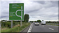
51 photos from this area
Area Information
Key information about the BA22 8ND including its size, population, and administrative classification.
- Area Type
- Postcode
- Area Size
- 5.8 hectares
- Population
- 1240
- Population Density
- 702 people/km²
House Prices in BA22 8ND
10
Properties
£143,286
Average Sold Price
£89,500
Lowest Price
£162,500
Highest Price
Showing 10 properties
| Address | Type | Beds | Baths | Last Sale Price | Last Sale Date | |
|---|---|---|---|---|---|---|
| 40 Abbots Road, Ilchester, Yeovil, BA22 8ND | Terraced | 2 | - | £130,000 | Aug 2014 | |
| 36 Abbots Road, Ilchester, Yeovil, BA22 8ND | Terraced | 2 | 1 | £150,000 | Jun 2014 | |
| 37 Abbots Road, Ilchester, Yeovil, BA22 8ND | house | - | - | £162,500 | Oct 2011 | |
| 42 Abbots Road, Ilchester, Yeovil, BA22 8ND | house | 3 | - | £160,000 | Aug 2011 | |
| 38 Abbots Road, Ilchester, Yeovil, BA22 8ND | Terraced | - | - | £156,000 | Nov 2007 | |
| 34 Abbots Road, Ilchester, Yeovil, BA22 8ND | Terraced | - | - | £155,000 | Feb 2003 | |
| 39 Abbots Road, Ilchester, Yeovil, BA22 8ND | Detached | 3 | 2 | £89,500 | Oct 2000 | |
| 35 Abbots Road, Ilchester, Yeovil, BA22 8ND | Semi-detached | - | - | - | - | |
| Wessex Water Sewage Treatment Works, Pill Bridge Lane, Ilchester, Yeovil, BA22 8ND | Industrial | - | - | - | - | |
| 33 Abbots Road, Ilchester, Yeovil, BA22 8ND | Semi-detached | - | - | - | - |
Energy Efficiency in BA22 8ND
Amenities
Schools
| Rank | School | Type | Entry gender | Ages |
|---|
Explore more schools in this area
Go to Schools tabDemographics
Household Size
Family (3-5 people)
most common
Accommodation Type
Houses
most common
Tenure
36
majority
Ethnic Group
White
most common
Religion
N/A
most common
Household Composition
N/A
most common
Age
47
median
Adults (30-64 years)
most common
Household Deprivation
N/A
with no deprivation
NS-SEC
42
in Lower managerial occupations
Explore more demographic insights in this area
Go to Demographics tabPlanning
Planning Constraints
- Flood RiskPremium
- Ramsar Wetland SitesPremium
- Area of Outstanding Natural BeautyPremium
- Protected Nature ReservePremium
- Protected WoodlandPremium