Area Overview for BA22 8NY
Photos of BA22 8NY
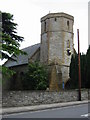
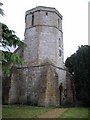
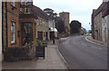
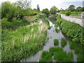
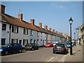
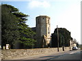
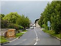
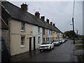
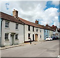
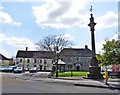
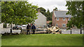
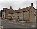
100 photos from this area
Area Information
Key information about the BA22 8NY including its size, population, and administrative classification.
- Area Type
- Postcode
- Area Size
- 2.2 hectares
- Population
- 1240
- Population Density
- 702 people/km²
House Prices in BA22 8NY
15
Properties
£222,244
Average Sold Price
£65,000
Lowest Price
£770,000
Highest Price
Showing 15 properties
| Address | Type | Beds | Baths | Last Sale Price | Last Sale Date | |
|---|---|---|---|---|---|---|
| 15 Priory Road, Ilchester, Yeovil, BA22 8NY | Semi-detached | 3 | 1 | £240,000 | Jul 2023 | |
| 7 Priory Road, Ilchester, Yeovil, BA22 8NY | house | - | - | £170,000 | Aug 2021 | |
| Nowra, Priory Road, Ilchester, Yeovil, BA22 8NY | Detached | 5 | 5 | £770,000 | Mar 2021 | |
| 11 Priory Road, Ilchester, Yeovil, BA22 8NY | house | - | - | £180,000 | Oct 2020 | |
| 1 Priory Road, Ilchester, Yeovil, BA22 8NY | Terraced | 2 | 1 | £141,500 | Apr 2015 | |
| 5 Priory Road, Ilchester, Yeovil, BA22 8NY | Terraced | 2 | 1 | £65,000 | Nov 2000 | |
| A Sikhiu, Priory Road, Ilchester, Yeovil, BA22 8NY | house | 3 | 1 | £69,950 | Sep 1999 | |
| Croft House, Priory Road, Ilchester, Yeovil, BA22 8NY | house | - | - | £141,500 | Jul 1995 | |
| Office, Nowra, Priory Road, Ilchester, Yeovil, BA22 8NY | Office | - | - | - | - | |
| Devereux, Priory Road, Ilchester, Yeovil, BA22 8NY | Detached | - | - | - | - |
Page 1 of 2
Energy Efficiency in BA22 8NY
Amenities
Schools
| Rank | School | Type | Entry gender | Ages |
|---|
Explore more schools in this area
Go to Schools tabDemographics
Household Size
Family (3-5 people)
most common
Accommodation Type
Houses
most common
Tenure
36
majority
Ethnic Group
White
most common
Religion
N/A
most common
Household Composition
N/A
most common
Age
47
median
Adults (30-64 years)
most common
Household Deprivation
N/A
with no deprivation
NS-SEC
42
in Lower managerial occupations
Explore more demographic insights in this area
Go to Demographics tabPlanning
Planning Constraints
- Flood RiskPremium
- Ramsar Wetland SitesPremium
- Area of Outstanding Natural BeautyPremium
- Protected Nature ReservePremium
- Protected WoodlandPremium