Area Overview for BA2 8AW
Photos of BA2 8AW
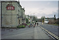
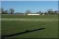
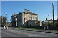
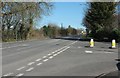
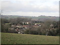
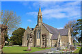
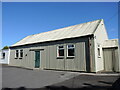
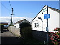
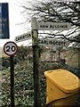
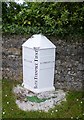
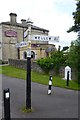
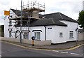
13 photos from this area
Area Information
Key information about the BA2 8AW including its size, population, and administrative classification.
- Area Type
- Postcode
- Area Size
- 9.4 hectares
- Population
- 1621
- Population Density
- 938 people/km²
House Prices in BA2 8AW
11
Properties
£244,325
Average Sold Price
£58,000
Lowest Price
£615,000
Highest Price
Showing 11 properties
| Address | Type | Beds | Baths | Last Sale Price | Last Sale Date | |
|---|---|---|---|---|---|---|
| Tufty Vole Cottage, 96 Carlingcott Lane, Carlingcott, Bath, BA2 8AW | house | - | - | £615,000 | Aug 2023 | |
| 94 Carlingcott Lane, Carlingcott, Bath, BA2 8AW | Terraced | - | - | £59,975 | Nov 2000 | |
| 92 Carlingcott Lane, Carlingcott, Bath, BA2 8AW | Terraced | - | - | £58,000 | Dec 1998 | |
| 33 Carlingcott Lane, Carlingcott, Bath, BA2 8AW | Detached | 4 | 3 | - | - | |
| Spring House, 98 Carlingcott Lane, Carlingcott, Bath, BA2 8AW | Detached | 3 | 2 | - | - | |
| 84 Carlingcott Lane, Carlingcott, Bath, BA2 8AW | house | 3 | - | - | - | |
| The Barn, Carlingcott Lane, Carlingcott, Bath, BA2 8AW | Detached | - | - | - | - | |
| 88 Carlingcott Lane, Carlingcott, Bath, BA2 8AW | Terraced | - | - | - | - | |
| 86 Carlingcott Lane, Carlingcott, Bath, BA2 8AW | house | - | - | - | - | |
| Osborne House, 82 Carlingcott Lane, Carlingcott, Bath, BA2 8AW | Detached | - | - | - | - |
Page 1 of 2
Energy Efficiency in BA2 8AW
Amenities
Schools
| Rank | School | Type | Entry gender | Ages |
|---|
Explore more schools in this area
Go to Schools tabDemographics
Household Size
Two person
most common
Accommodation Type
Houses
most common
Tenure
86
majority
Ethnic Group
White
most common
Religion
N/A
most common
Household Composition
N/A
most common
Age
47
median
Adults (30-64 years)
most common
Household Deprivation
N/A
with no deprivation
NS-SEC
37
in Lower managerial occupations
Explore more demographic insights in this area
Go to Demographics tabPlanning
Planning Constraints
- Flood RiskPremium
- Ramsar Wetland SitesPremium
- Area of Outstanding Natural BeautyPremium
- Protected Nature ReservePremium
- Protected WoodlandPremium