Area Overview for BA2 8AH
Photos of BA2 8AH
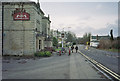
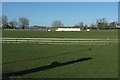

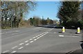
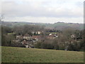

13 photos from this area
Area Information
Key information about the BA2 8AH including its size, population, and administrative classification.
- Area Type
- Postcode
- Area Size
- 5.1 hectares
- Population
- 1621
- Population Density
- 938 people/km²
House Prices in BA2 8AH
15
Properties
£148,629
Average Sold Price
£39,950
Lowest Price
£250,000
Highest Price
Showing 15 properties
| Address | Type | Beds | Baths | Last Sale Price | Last Sale Date | |
|---|---|---|---|---|---|---|
| 1 Lower Church Road, Peasedown St John, Bath, BA2 8AH | Terraced | 3 | 2 | £225,000 | Aug 2019 | |
| Prospect House, Lower Church Road, Peasedown St John, Bath, BA2 8AH | house | - | - | £250,000 | Jan 2015 | |
| 5 Lower Church Road, Peasedown St John, Bath, BA2 8AH | house | - | - | £187,000 | Oct 2010 | |
| Orchard Leigh, Lower Church Road, Peasedown St John, Bath, BA2 8AH | Detached | 4 | - | £105,000 | Feb 2001 | |
| Willow Glade, Lower Church Road, Peasedown St John, Bath, BA2 8AH | Semi-detached | - | - | £104,950 | Nov 1997 | |
| 3 Lower Church Road, Peasedown St John, Bath, BA2 8AH | Terraced | - | - | £39,950 | Jul 1995 | |
| The Old Manse, Lower Church Road, Peasedown St John, Bath, BA2 8AH | Detached | - | - | £128,500 | Jul 1995 | |
| The White Cottage, Lower Church Road, Peasedown St John, Bath, BA2 8AH | Detached | 4 | 2 | - | - | |
| 4 Lower Church Road, Peasedown St John, Bath, BA2 8AH | Detached | 4 | 2 | - | - | |
| The Beeches, Lower Church Road, Peasedown St John, Bath, BA2 8AH | house | - | - | - | - |
Page 1 of 2
Energy Efficiency in BA2 8AH
Amenities
Schools
| Rank | School | Type | Entry gender | Ages |
|---|
Explore more schools in this area
Go to Schools tabDemographics
Household Size
Two person
most common
Accommodation Type
Houses
most common
Tenure
86
majority
Ethnic Group
White
most common
Religion
N/A
most common
Household Composition
N/A
most common
Age
47
median
Adults (30-64 years)
most common
Household Deprivation
N/A
with no deprivation
NS-SEC
37
in Lower managerial occupations
Explore more demographic insights in this area
Go to Demographics tabPlanning
Planning Constraints
- Flood RiskPremium
- Ramsar Wetland SitesPremium
- Area of Outstanding Natural BeautyPremium
- Protected Nature ReservePremium
- Protected WoodlandPremium