Area Overview for BA2 6QE
Photos of BA2 6QE


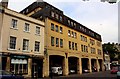


100 photos from this area
Area Information
Key information about the BA2 6QE including its size, population, and administrative classification.
- Area Type
- Postcode
- Area Size
- 1.9 hectares
- Population
- 1474
- Population Density
- 6367 people/km²
House Prices in BA2 6QE
25
Properties
£728,438
Average Sold Price
£275,000
Lowest Price
£2,750,000
Highest Price
Showing 25 properties
| Address | Type | Beds | Baths | Last Sale Price | Last Sale Date | |
|---|---|---|---|---|---|---|
| 25 Forester Road, Bathwick, Bath, BA2 6QE | Semi-detached | 5 | 3 | £1,220,000 | Jul 2024 | |
| 31 Forester Road, Bathwick, Bath, BA2 6QE | house | - | - | £855,000 | Jun 2021 | |
| 26 Forester Road, Bathwick, Bath, BA2 6QE | house | - | - | £940,000 | Oct 2018 | |
| 27 Forester Road, Bathwick, Bath, BA2 6QE | Semi-detached | 5 | 2 | £927,500 | Jul 2018 | |
| 29 Forester Road, Bathwick, Bath, BA2 6QE | Semi-detached | 5 | 3 | £2,750,000 | Mar 2017 | |
| 34 Forester Road, Bathwick, Bath, BA2 6QE | Semi-detached | 3 | - | £540,000 | Dec 2014 | |
| 28 Forester Road, Bathwick, Bath, BA2 6QE | house | - | - | £640,000 | Feb 2011 | |
| 37 Forester Road, Bathwick, Bath, BA2 6QE | Detached | - | - | £500,000 | Jul 2007 | |
| 24 Forester Road, Bathwick, Bath, BA2 6QE | Semi-detached | 6 | - | £595,000 | Sep 2006 | |
| 40 Forester Road, Bathwick, Bath, BA2 6QE | Detached | - | - | £395,000 | Jan 2006 |
Page 1 of 3
Energy Efficiency in BA2 6QE
Amenities
Schools
| Rank | School | Type | Entry gender | Ages |
|---|
Explore more schools in this area
Go to Schools tabDemographics
Household Size
One person
most common
Accommodation Type
Flats
most common
Tenure
50
majority
Ethnic Group
White
most common
Religion
N/A
most common
Household Composition
N/A
most common
Age
47
median
Adults (30-64 years)
most common
Household Deprivation
N/A
with no deprivation
NS-SEC
48
in Lower managerial occupations
Explore more demographic insights in this area
Go to Demographics tabPlanning
Planning Constraints
- Flood RiskPremium
- Ramsar Wetland SitesPremium
- Area of Outstanding Natural BeautyPremium
- Protected Nature ReservePremium
- Protected WoodlandPremium