Area Overview for BA1 6AE
Photos of BA1 6AE


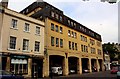


100 photos from this area
Area Information
Key information about the BA1 6AE including its size, population, and administrative classification.
- Area Type
- Postcode
- Area Size
- 2.3 hectares
- Population
- 1474
- Population Density
- 6367 people/km²
House Prices in BA1 6AE
8
Properties
£540,000
Average Sold Price
£540,000
Lowest Price
£540,000
Highest Price
Showing 8 properties
| Address | Type | Beds | Baths | Last Sale Price | Last Sale Date | |
|---|---|---|---|---|---|---|
| 6, York Place, London Road, Walcot, Bath, BA1 6AE | Terraced | 2 | - | £540,000 | Nov 2018 | |
| 5, York Place, London Road, Walcot, Bath, BA1 6AE | Retail | 3 | 2 | - | - | |
| Tr Hayes Warehouse, York Place, London Road, Walcot, Bath, BA1 6AE | warehouse | - | - | - | - | |
| 4A, Flat 1, York Place, London Road, Walcot, Bath, BA1 6AE | Flat | 2 | 2 | - | - | |
| 4B, The Coach House, York Place, London Road, Walcot, Bath, BA1 6AE | house | 2 | - | - | - | |
| 4A, Flat 2, York Place, London Road, Walcot, Bath, BA1 6AE | Flat | - | - | - | - | |
| Norland Nursery Training College, York Place, London Road, Walcot, Bath, BA1 6AE | commercial | - | - | - | - | |
| Riverside Youth Hub, London Road, Walcot, Bath, BA1 6AE | community_day_centre | - | - | - | - |
Energy Efficiency in BA1 6AE
Amenities
Schools
| Rank | School | Type | Entry gender | Ages |
|---|
Explore more schools in this area
Go to Schools tabDemographics
Household Size
One person
most common
Accommodation Type
Flats
most common
Tenure
50
majority
Ethnic Group
White
most common
Religion
N/A
most common
Household Composition
N/A
most common
Age
47
median
Adults (30-64 years)
most common
Household Deprivation
N/A
with no deprivation
NS-SEC
48
in Lower managerial occupations
Explore more demographic insights in this area
Go to Demographics tabPlanning
Planning Constraints
- Flood RiskPremium
- Ramsar Wetland SitesPremium
- Area of Outstanding Natural BeautyPremium
- Protected Nature ReservePremium
- Protected WoodlandPremium