Area Overview for BA15 2DZ
Photos of BA15 2DZ
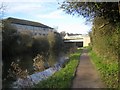
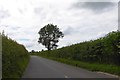
![Underwoods Bridge [No 171] from the south-east in BA15 2DZ](https://images.propbar.co.uk/images/geograph/44/75/4475943_120.jpg)
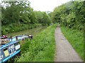
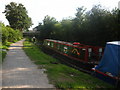
![Treenwood Industrial Estate [1] in BA15 2DZ](https://images.propbar.co.uk/images/geograph/58/80/5880677_120.jpg)
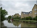
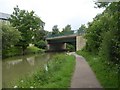
![Treenwood Industrial Estate [2] in BA15 2DZ](https://images.propbar.co.uk/images/geograph/58/80/5880679_120.jpg)
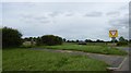
51 photos from this area
Area Information
Key information about the BA15 2DZ including its size, population, and administrative classification.
- Area Type
- Postcode
- Area Size
- 6.8 hectares
- Population
- 1581
- Population Density
- 880 people/km²
House Prices in BA15 2DZ
2
Properties
£385,000
Average Sold Price
£385,000
Lowest Price
£385,000
Highest Price
Showing 2 properties
| Address | Type | Beds | Baths | Last Sale Price | Last Sale Date | |
|---|---|---|---|---|---|---|
| The Beretun, Frome Road, Bradford On Avon, BA15 2DZ | house | - | - | £385,000 | Jun 2021 | |
| Caravan, The Beretun, Frome Road, Bradford On Avon, BA15 2DZ | Mobile Home | - | - | - | - |
Energy Efficiency in BA15 2DZ
Amenities
Schools
| Rank | School | Type | Entry gender | Ages |
|---|
Explore more schools in this area
Go to Schools tabDemographics
Household Size
Two person
most common
Accommodation Type
Houses
most common
Tenure
78
majority
Ethnic Group
White
most common
Religion
N/A
most common
Household Composition
N/A
most common
Age
47
median
Adults (30-64 years)
most common
Household Deprivation
N/A
with no deprivation
NS-SEC
47
in Lower managerial occupations
Explore more demographic insights in this area
Go to Demographics tabPlanning
Planning Constraints
- Flood RiskPremium
- Ramsar Wetland SitesPremium
- Area of Outstanding Natural BeautyPremium
- Protected Nature ReservePremium
- Protected WoodlandPremium