Area Overview for BA15 2AL
Photos of BA15 2AL
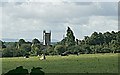
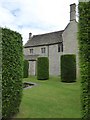
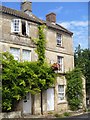
![Path crosses the road [1] in BA15 2AL](https://images.propbar.co.uk/images/geograph/58/35/5835215_120.jpg)
100 photos from this area
Area Information
Key information about the BA15 2AL including its size, population, and administrative classification.
- Area Type
- Postcode
- Area Size
- 69.9 hectares
- Population
- 1128
- Population Density
- 292 people/km²
House Prices in BA15 2AL
9
Properties
£765,000
Average Sold Price
£700,000
Lowest Price
£830,000
Highest Price
Showing 9 properties
| Address | Type | Beds | Baths | Last Sale Price | Last Sale Date | |
|---|---|---|---|---|---|---|
| Wyngates Cottage, Elms Cross, Bradford On Avon, BA15 2AL | Bungalow | - | - | £700,000 | Dec 2022 | |
| Berksholme, 70 Elms Cross, Bradford On Avon, BA15 2AL | Bungalow | - | - | £830,000 | Apr 2021 | |
| Wyngates, Elms Cross, Bradford On Avon, BA15 2AL | Semi-detached | - | - | - | - | |
| Elms Cross Stables, Elms Cross, Bradford On Avon, BA15 2AL | Detached | - | - | - | - | |
| The Vineyard, 72 Elms Cross, Bradford On Avon, BA15 2AL | Detached | - | - | - | - | |
| Elms Cross House, Elms Cross, Bradford On Avon, BA15 2AL | Detached | - | - | - | - | |
| Granby Cottage, Elms Cross, Bradford On Avon, BA15 2AL | Detached | - | - | - | - | |
| Cloudshill, 71 Elms Cross, Bradford On Avon, BA15 2AL | house | - | - | - | - | |
| Granby House, Elms Cross, Bradford On Avon, BA15 2AL | Bungalow | - | - | - | - |
Energy Efficiency in BA15 2AL
Amenities
Schools
| Rank | School | Type | Entry gender | Ages |
|---|
Explore more schools in this area
Go to Schools tabDemographics
Household Size
Two person
most common
Accommodation Type
Houses
most common
Tenure
81
majority
Ethnic Group
White
most common
Religion
N/A
most common
Household Composition
N/A
most common
Age
47
median
Adults (30-64 years)
most common
Household Deprivation
N/A
with no deprivation
NS-SEC
49
in Lower managerial occupations
Explore more demographic insights in this area
Go to Demographics tabPlanning
Planning Constraints
- Flood RiskPremium
- Ramsar Wetland SitesPremium
- Area of Outstanding Natural BeautyPremium
- Protected Nature ReservePremium
- Protected WoodlandPremium