Area Overview for BA14 9RF
Photos of BA14 9RF
Area Information
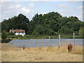
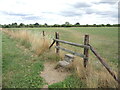
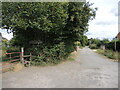
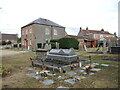
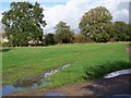
BA14 9RF defines a specific residential cluster within the BA14 postcode area, covering a modest total footprint of 4,184 square metres. Despite its small physical size, this location supports a population of 2,456 residents, creating a tightly knit community environment. The area is situated in south-west England, historically forming part of the village of Southwick, which lies just three miles from Trowbridge. This postcode zone sits at the heart of a semi-rural civil parish, offering a blend of immediate residential convenience and proximity to the surrounding Wiltshire countryside. Daily life here is characterised by low population density, with approximately 142 people per square kilometre. This figure suggests ample space and a quiet atmosphere compared to larger urban centres. The demographic profile indicates a stable community, with the majority of residents being adults aged between 30 and 64 years. This age distribution points towards a neighbourhood settled by families and established households rather than a transient student population. Living in BA14 9RF means residing in an established village setting where the built environment has evolved from historic agricultural roots into a modern residential zone. The cluster offers a distinct advantage for those seeking a slower pace of life while remaining within reach of established town centres and local services.
- Area Type
- Postcode
- Area Size
- 4184 m²
- Population
- 2456
- Population Density
- 142 people/km²
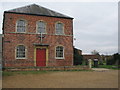
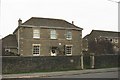
The housing market in BA14 9RF is dominated by privately owned houses, reflecting a robust local property sector. With 80% of homes owned outright or with a mortgage, the area clearly functions as an owner-occupied zone. This statistic stands in stark contrast to high-density rental estates common in urban centres. The predominant accommodation type is the house, which aligns with the semi-rural character of the Southwick civil parish. This means buyers looking at BA14 9RF are unlikely to find modern apartment blocks or purpose-built flats. Instead, the stock consists of detached or semi-detached properties, many of which date back centuries. Historical records indicate that the local economy has long been influenced by agriculture and cloth weaving, leading to a存量 of historic farmhouses and cottages. Properties here often feature traditional architecture, such as the 17th-century Brook House or the Poplars built circa 1650, though modern developments create a largely rectangular settlement pattern to the south of the main road. The high ownership rate suggests strong local attachment to these properties, which often commands stability in local property values. For buyers, this environment offers the chance to purchase substantial living space rather than compact city living. The absence of significant rental investment suggests a market driven by local families and professionals rather than investor portfolios seeking high-yield properties.
House Prices in BA14 9RF
Showing 6 properties
| Address | Type | Beds | Baths | Last Sale Price | Last Sale Date | |
|---|---|---|---|---|---|---|
| 36 Wynsome Street, Southwick, BA14 9RF | Bungalow | - | - | £240,000 | Dec 2021 | |
| 32 Wynsome Street, Southwick, BA14 9RF | Detached | 3 | 1 | £320,000 | Mar 2017 | |
| 11B Wynsome Street, Southwick, BA14 9RF | Detached | 3 | 2 | - | - | |
| Land Adjacent 32, Wynsome Street, Southwick, BA14 9RF | undefined | - | - | - | - | |
| 11A Wynsome Street, Southwick, BA14 9RF | Detached | - | - | - | - | |
| 11C Wynsome Street, Southwick, BA14 9RF | Detached | - | - | - | - |
Energy Efficiency in BA14 9RF
Living in BA14 9RF provides practical access to a range of retail and transport amenities within a short radius. For daily shopping needs, residents are close to Tesco Trowbridge, Aldi North, and Budgens North. These outlets offer essential groceries and household goods without the need for long car journeys. The availability of these major retailers ensures that household management is straightforward and convenient. Beyond food and essentials, the area sits near key transport hubs, including Trowbridge Railway Station, Westbury Railway Station, and Dilton Marsh Railway Station. These railway connections face residents at Trowbridge and Dilton Marsh, providing travel links to London and other regional centres. Access to Trowbridge Railway Station is particularly notable given the village's proximity to the county town. This transport network allows for weekend trips to other historic market towns or easy commuting for those working in larger urban jobs. The combination of nearby supermarkets and accessible rail services creates a self-sufficient lifestyle. Families can manage daily errands locally while having the option to travel further for leisure or work. This balance of local convenience and regional connectivity is a defining feature of life in BA14 9RF. Residents do not need to sacrifice accessibility for the peace of a semi-rural village setting.
Amenities
Schools
Families in BA14 9RF have access to a selection of educational institutions in the immediate vicinity. Close to the postcode are Southwick Church of England Primary School and Wingfield CofE Primary School (VA), both of which serve as mainstream state primary options for local children. These schools provide full-time religious education within a local community setting. For independent education options, residents can access LUMIAR STOWFORD SCHOOL, though it carries an insufficient Ofsted rating. The presence of multiple primary schools indicates a viable local educational catchment for young families. The mix of school types offers parents choices between state-maintained faith schools and independent provision. However, the independent option listed has specific regulatory ratings that families must consider during school selection. State primary schools generally offer a community-focused curriculum integrated with local history and traditions, fitting the village settlement profile. The proximity of these schools to BA14 9RF reduces commute times for parents dropping off or picking up children. Families considering buying homes in this area should verify current school admission criteria and upcoming intake numbers, as capacity can shift annually. This educational landscape supports the demographic of adults with children, reinforcing the stability of the 30-64 year age group as the most common residents.
| Rank | School | Type | Entry gender | Ages |
|---|
Explore more schools in this area
Go to Schools tabDemographics
The community profile within BA14 9RF demonstrates a highly stable population structure. Eighty per cent of residents own their homes, a figure that validates the area as a long-term residential destination rather than a transient rental market. This high level of home ownership, combined with the fact that houses are the predominant accommodation type, indicates a neighbourhood where occupants typically have deep roots in the local community. The demographic data further reveals that adults aged between 30 and 64 years form the most common age range, confirming that the area is not skewed towards children or the very elderly. Cultural diversity in this specific cluster is defined by the fact that the White ethnic group is the predominant demographic. While the area supports a settled population, the specific breakdown of other ethnicities is not detailed in local records. The median age of 47 years suggests a mature community where families have likely been raising children in the same homes for generations. This age profile often correlates with stability, meaning neighbours tend to know each other well and community engagement is likely high. Such a demographic profile creates an environment suited to those seeking quietude and established social networks. The consistency of these figures from 30 to 64 years old implies that the local amenities and services are oriented towards the needs of working-age adults and their households.
Household Size
Accommodation Type
Tenure
Ethnic Group
Religion
Household Composition
Age
Household Deprivation
NS-SEC
Explore more demographic insights in this area
Go to Demographics tabPlanning
Planning Constraints
- Flood RiskPremium
- Ramsar Wetland SitesPremium
- Area of Outstanding Natural BeautyPremium
- Protected Nature ReservePremium
- Protected WoodlandPremium