Area Overview for BA14 9PP
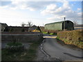
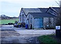
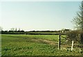
Photos of BA14 9PP
Area Information
Residing in BA14 9PP means living within a specific postcode area that covers a small residential cluster spanning 7.7 hectares. This location represents Southwick, a semi-rural civil parish and village situated approximately 2456 people strong. The modern parish lies on the road to Frome, with modern housing forming a largely rectangular settlement to the south of the main road. This area falls under the BA14 postcode area at coordinates 51.301934, -2.259578. Life here blends rural history with contemporary suburban living. The village has deep historical roots, having been part of Steeple Ashton manor in Anglo-Saxon times. Until 1300, the area was covered by the extensive Selwood Forest. Settlement occurred around the junction of the Bradley road and the Trowbridge-Frome road. Modern residents benefit from proximity to the county town of Trowbridge while maintaining a distinct village character. The population density is 142 people per square kilometre, indicating a spread-out yet accessible community. You live in an environment where historic farms coexist with recent developments, offering a quiet retreat from the city. The rectangular nature of the modern settlement contrasts with the organic layout of the historic village centre. This specific residential cluster provides a compact feel despite the open space surrounding it.
- Area Type
- Postcode
- Area Size
- 7.7 hectares
- Population
- 2456
- Population Density
- 142 people/km²
The property market in BA14 9PP is defined by a strong preference for house ownership. Eighty per cent of residents are homeowners, which signals a mature market driven by owners rather than renters. The predominant accommodation type is houses, meaning flats or apartments are not the primary housing stock here. You will find a landscape dominated by houses suitable for families or individuals seeking a detached or semi-detached lifestyle. This high ownership rate of 80 per cent suggests that much of the housing stock was built or purchased for longevity. The property market in this small area of 7.7 hectares is likely stable due to the proportion of owners. Buyers looking for homes in BA14 9PP should expect properties that have been cared for by successive generations. The low density of one thousand four hundred twenty people per square kilometre supports this perception of spacious housing. New developments, such as the modern housing to the south of the main road, cater to this demand for houses. The area does not feature the high-rise density or shared ownership schemes typical of inner-city markets. Instead, it offers traditional conveyancing for houses where buyers build equity over time. The 80% ownership figure implies lower turnover rates compared to investment-led rental zones.
House Prices in BA14 9PP
Showing 3 properties
| Address | Type | Beds | Baths | Last Sale Price | Last Sale Date | |
|---|---|---|---|---|---|---|
| Apartment 2, Upper Poles Hole, Southwick, Southwick, BA14 9PP | Semi-detached | - | - | - | - | |
| Apartment 1, Upper Poles Hole, Southwick, Southwick, BA14 9PP | Bungalow | - | - | - | - | |
| Upper Poles Hole, Southwick, Southwick, BA14 9PP | Detached | - | - | - | - |
Energy Efficiency in BA14 9PP
Living in BA14 9PP offers convenient access to essential retail and transport hubs. Within practical reach are five retail options, including Tesco Trowbridge, Budgens North, and Aldi North. These supermarkets provide all the grocery shopping you need without extensive travel. Five railway stations serve the area, offering rail links via Trowbridge Railway Station, Westbury Railway Station, and Dilton Marsh Railway Station. You can commute east to Bath or west towards Bristol using these connections. The presence of five nearby amenities for retail and rail means you have frequent opportunities to travel without needing a car for every trip. Daily life involves easy access to fresh food at Tesco Trowbridge or Aldi North. The variety of transport nodes ensures you are not isolated from regional job markets. Sitting on the road to Frome, you also have access to broader road networks for driving travel. The specific inclusion of Budgens North adds variety to local shopping choices alongside the larger Tesco facility. Residential life balances village quiet with the convenience of mainline rail access.
Amenities
Schools
Families in BA14 9PP have access to a specific mix of educational institutions nearby. The nearest primary options include Southwick Church of England Primary School and Wingfield CofE Primary School (VA). These state-funded schools serve the local catchment areas for young children. For independent education, parents can consider LUMIAR STOWFORD SCHOOL. This institution holds an inadequate Ofsted rating, a critical fact for anyone evaluating educational quality. An inadequate rating indicates significant areas requiring improvement or serious concerns about standards at the school. The presence of two primary schools offers choice for local families, though selection between the two is often determined by proximity. The independent school provides an alternative curriculum but carries the risk associated with its current inspection rating. Families must weigh the location of these schools against the academic performance shown in official reports. Southwick Church of England Primary School repeats in the list of nearby options, confirming its significance to the local education network. While there are no secondary schools listed in the provided data, primary choices are established within the cluster. The mix illustrates a community reliant on state primary education with a single independent option nearby.
| Rank | School | Type | Entry gender | Ages |
|---|
Explore more schools in this area
Go to Schools tabDemographics
The community in BA14 9PP displays clear demographic characteristics defined by the data. The median age is 47 years, with adults aged thirty to sixty-four years representing the most common age range. This indicates a population skewed towards maturity and stability rather than young families or retirees. Home ownership stands at 80 per cent, establishing this as a predominantly owner-occupied area where residents have settled long-term. The predominant accommodation type consists of houses, reflecting the suburban and village nature of the settlement. Almost four out of five households own their property, suggesting lower transient rates compared to rental-heavy districts. The predominant ethnic group is White, aligning with the broader demographic profile of Wiltshire. With a median age of 47, the area offers a quiet environment where neighbours often know each other well. Children are less common in the immediate demographic profile, though schools serve the area well. The high rate of home ownership at 80 per cent contrasts with national averages where rental markets often grow. This stability means you are likely to buy into a property with established maintenance histories. The age profile supports a slower pace of life compared to younger, transient urban districts.
Household Size
Accommodation Type
Tenure
Ethnic Group
Religion
Household Composition
Age
Household Deprivation
NS-SEC
Explore more demographic insights in this area
Go to Demographics tabPlanning
Planning Constraints
- Flood RiskPremium
- Ramsar Wetland SitesPremium
- Area of Outstanding Natural BeautyPremium
- Protected Nature ReservePremium
- Protected WoodlandPremium