Area Overview for BA14 9BY
Photos of BA14 9BY
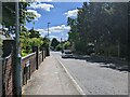

9 photos from this area
Area Information
Key information about the BA14 9BY including its size, population, and administrative classification.
- Area Type
- Postcode
- Area Size
- 1.2 hectares
- Population
- 1861
- Population Density
- 1663 people/km²
House Prices in BA14 9BY
18
Properties
£165,220
Average Sold Price
£50,750
Lowest Price
£325,000
Highest Price
Showing 18 properties
| Address | Type | Beds | Baths | Last Sale Price | Last Sale Date | |
|---|---|---|---|---|---|---|
| 45 Broadmead, Trowbridge, BA14 9BY | house | - | - | £325,000 | Feb 2025 | |
| 35 Broadmead, Trowbridge, BA14 9BY | Semi-detached | 3 | 1 | £233,000 | Jan 2020 | |
| 53 Broadmead, Trowbridge, BA14 9BY | Semi-detached | 4 | - | £250,000 | Apr 2016 | |
| 52 Broadmead, Trowbridge, BA14 9BY | house | - | - | £185,000 | Aug 2010 | |
| 61 Broadmead, Trowbridge, BA14 9BY | house | - | - | £152,000 | Aug 2006 | |
| 43 Broadmead, Trowbridge, BA14 9BY | Semi-detached | - | - | £140,000 | Feb 2004 | |
| 57 Broadmead, Trowbridge, BA14 9BY | Semi-detached | - | - | £127,000 | Sep 2003 | |
| 51 Broadmead, Trowbridge, BA14 9BY | Semi-detached | - | - | £87,500 | Jul 2000 | |
| 67 Broadmead, Trowbridge, BA14 9BY | Detached | - | - | £101,950 | Jul 1998 | |
| 59 Broadmead, Trowbridge, BA14 9BY | Semi-detached | - | - | £50,750 | Apr 1996 |
Page 1 of 2
Energy Efficiency in BA14 9BY
Amenities
Schools
| Rank | School | Type | Entry gender | Ages |
|---|
Explore more schools in this area
Go to Schools tabDemographics
Household Size
Two person
most common
Accommodation Type
Houses
most common
Tenure
90
majority
Ethnic Group
White
most common
Religion
N/A
most common
Household Composition
N/A
most common
Age
47
median
Adults (30-64 years)
most common
Household Deprivation
N/A
with no deprivation
NS-SEC
37
in Lower managerial occupations
Explore more demographic insights in this area
Go to Demographics tabPlanning
Planning Constraints
- Flood RiskPremium
- Ramsar Wetland SitesPremium
- Area of Outstanding Natural BeautyPremium
- Protected Nature ReservePremium
- Protected WoodlandPremium