Area Overview for BA14 6NB
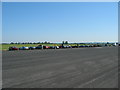
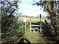
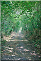
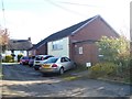
Photos of BA14 6NB
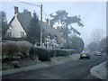
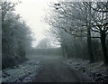
![Keevil houses [1] in BA14 6NB](https://images.propbar.co.uk/images/geograph/56/03/5603163_120.jpg)
![Keevil houses [2] in BA14 6NB](https://images.propbar.co.uk/images/geograph/56/03/5603164_120.jpg)
![Keevil houses [3] in BA14 6NB](https://images.propbar.co.uk/images/geograph/56/03/5603167_120.jpg)
![Keevil houses [4] in BA14 6NB](https://images.propbar.co.uk/images/geograph/56/03/5603169_120.jpg)
![Keevil houses [5] in BA14 6NB](https://images.propbar.co.uk/images/geograph/56/03/5603172_120.jpg)
![Keevil houses [6] in BA14 6NB](https://images.propbar.co.uk/images/geograph/56/04/5604937_120.jpg)
23 photos from this area
Area Information
Key information about the BA14 6NB including its size, population, and administrative classification.
- Area Type
- Postcode
- Area Size
- 20.4 hectares
- Population
- 1505
- Population Density
- 65 people/km²
House Prices in BA14 6NB
10
Properties
£250,921
Average Sold Price
£97,000
Lowest Price
£371,500
Highest Price
Showing 10 properties
| Address | Type | Beds | Baths | Last Sale Price | Last Sale Date | |
|---|---|---|---|---|---|---|
| The Beeches, 3 Martins Lane, Keevil, BA14 6NB | Bungalow | - | - | £371,500 | Apr 2019 | |
| 5 Martins Lane, Keevil, BA14 6NB | Bungalow | - | - | £360,000 | Nov 2016 | |
| 11 Martins Lane, Keevil, BA14 6NB | Bungalow | - | - | £363,000 | Apr 2015 | |
| The Roscote, 6 Martins Lane, Keevil, BA14 6NB | Bungalow | 3 | 2 | £189,950 | Nov 2000 | |
| 13 Martins Lane, Keevil, BA14 6NB | Bungalow | - | - | £165,000 | Aug 1997 | |
| Forge Cottage, 2 Martins Lane, Keevil, BA14 6NB | Detached | - | - | £210,000 | Oct 1996 | |
| 9 Martins Lane, Keevil, BA14 6NB | Bungalow | - | - | £97,000 | Jul 1996 | |
| 13A Martins Lane, Keevil, BA14 6NB | Bungalow | - | - | - | - | |
| 7 Martins Lane, Keevil, BA14 6NB | Bungalow | - | - | - | - | |
| 4 Martins Lane, Keevil, BA14 6NB | Detached | - | - | - | - |
Energy Efficiency in BA14 6NB
Amenities
Schools
| Rank | School | Type | Entry gender | Ages |
|---|
Explore more schools in this area
Go to Schools tabDemographics
Household Size
Two person
most common
Accommodation Type
Houses
most common
Tenure
86
majority
Ethnic Group
White
most common
Religion
N/A
most common
Household Composition
N/A
most common
Age
47
median
Adults (30-64 years)
most common
Household Deprivation
N/A
with no deprivation
NS-SEC
46
in Lower managerial occupations
Explore more demographic insights in this area
Go to Demographics tabPlanning
Planning Constraints
- Flood RiskPremium
- Ramsar Wetland SitesPremium
- Area of Outstanding Natural BeautyPremium
- Protected Nature ReservePremium
- Protected WoodlandPremium