Area Overview for BA14 6LX
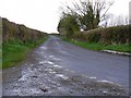
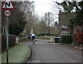
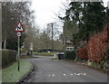
Photos of BA14 6LX

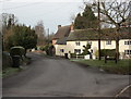
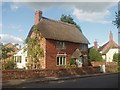
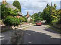
![Longleaze Farmhouse [1] in BA14 6LX](https://images.propbar.co.uk/images/geograph/56/08/5608866_120.jpg)
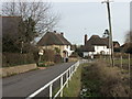
![Longleaze Farmhouse [2] in BA14 6LX](https://images.propbar.co.uk/images/geograph/56/08/5608867_120.jpg)
36 photos from this area
Area Information
Key information about the BA14 6LX including its size, population, and administrative classification.
- Area Type
- Postcode
- Area Size
- 1.0 hectares
- Population
- 1505
- Population Density
- 65 people/km²
House Prices in BA14 6LX
12
Properties
£422,500
Average Sold Price
£420,000
Lowest Price
£425,000
Highest Price
Showing 12 properties
| Address | Type | Beds | Baths | Last Sale Price | Last Sale Date | |
|---|---|---|---|---|---|---|
| 39 Main Street, Keevil, BA14 6LX | Bungalow | 3 | 1 | £420,000 | Nov 2023 | |
| The Old Stables, 41A Main Street, Keevil, BA14 6LX | Terraced | 2 | - | £425,000 | Jul 2010 | |
| The Weavers Cottage, 38 Main Street, Keevil, BA14 6LX | Detached | 4 | 2 | - | - | |
| Rose And Crown Cottages, 74A Main Street, Keevil, BA14 6LX | Cottage | 2 | 1 | - | - | |
| Box Tree Cottage, 40 Main Street, Keevil, BA14 6LX | Cottage | 3 | - | - | - | |
| Rose And Crown Cottages, 74D Main Street, Keevil, BA14 6LX | Terraced | 2 | 1 | - | - | |
| Rose And Crown Cottages, 74C Main Street, Keevil, BA14 6LX | Terraced | - | - | - | - | |
| Rose And Crown Cottages, 74B Main Street, Keevil, BA14 6LX | Cottage | 2 | 1 | - | - | |
| 74 Main Street, Keevil, BA14 6LX | Terraced | 2 | 1 | - | - | |
| The Old Cobblers, 73 Main Street, Keevil, BA14 6LX | Detached | - | - | - | - |
Page 1 of 2
Energy Efficiency in BA14 6LX
Amenities
Schools
| Rank | School | Type | Entry gender | Ages |
|---|
Explore more schools in this area
Go to Schools tabDemographics
Household Size
Two person
most common
Accommodation Type
Houses
most common
Tenure
86
majority
Ethnic Group
White
most common
Religion
N/A
most common
Household Composition
N/A
most common
Age
47
median
Adults (30-64 years)
most common
Household Deprivation
N/A
with no deprivation
NS-SEC
46
in Lower managerial occupations
Explore more demographic insights in this area
Go to Demographics tabPlanning
Planning Constraints
- Flood RiskPremium
- Ramsar Wetland SitesPremium
- Area of Outstanding Natural BeautyPremium
- Protected Nature ReservePremium
- Protected WoodlandPremium