Area Overview for BA12 8NN
Photos of BA12 8NN
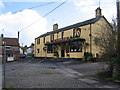
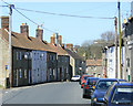
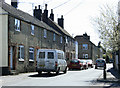
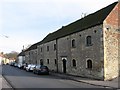
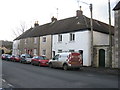
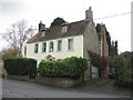
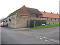
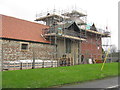
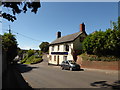
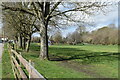
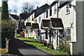
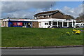
72 photos from this area
Area Information
Key information about the BA12 8NN including its size, population, and administrative classification.
- Area Type
- Postcode
- Area Size
- 8094 m²
- Population
- 1491
- Population Density
- 3501 people/km²
House Prices in BA12 8NN
12
Properties
£253,071
Average Sold Price
£91,500
Lowest Price
£475,000
Highest Price
Showing 12 properties
| Address | Type | Beds | Baths | Last Sale Price | Last Sale Date | |
|---|---|---|---|---|---|---|
| 57 Pound Street, Warminster, BA12 8NN | Terraced | 2 | 1 | £220,000 | May 2025 | |
| 61 Pound Street, Warminster, BA12 8NN | Terraced | 3 | 1 | £250,000 | May 2024 | |
| 59 Pound Street, Warminster, BA12 8NN | Terraced | 2 | 1 | £245,000 | May 2024 | |
| Pound Cottage, 26 Pound Street, Warminster, BA12 8NN | Semi-detached | 2 | 1 | £330,000 | Nov 2023 | |
| 24 Pound Street, Warminster, BA12 8NN | Semi-detached | 2 | 1 | £475,000 | Jul 2018 | |
| 63 Pound Street, Warminster, BA12 8NN | house | 2 | - | £160,000 | Feb 2018 | |
| 37 Pound Street, Warminster, BA12 8NN | house | - | - | £91,500 | May 2014 | |
| 2, Curtis Close, Pound Street, Warminster, BA12 8NN | Semi-detached | 2 | 1 | - | - | |
| 53-55 Pound Street, Warminster, BA12 8NN | Terraced | - | - | - | - | |
| 61A Pound Street, Warminster, BA12 8NN | Bungalow | - | - | - | - |
Page 1 of 2
Energy Efficiency in BA12 8NN
Amenities
Schools
| Rank | School | Type | Entry gender | Ages |
|---|
Explore more schools in this area
Go to Schools tabDemographics
Household Size
One person
most common
Accommodation Type
Houses
most common
Tenure
60
majority
Ethnic Group
White
most common
Religion
N/A
most common
Household Composition
N/A
most common
Age
47
median
Adults (30-64 years)
most common
Household Deprivation
N/A
with no deprivation
NS-SEC
27
in Lower managerial occupations
Explore more demographic insights in this area
Go to Demographics tabPlanning
Planning Constraints
- Flood RiskPremium
- Ramsar Wetland SitesPremium
- Area of Outstanding Natural BeautyPremium
- Protected Nature ReservePremium
- Protected WoodlandPremium