Area Overview for BA12 8NJ
Photos of BA12 8NJ
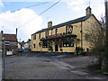
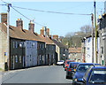
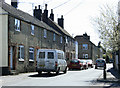
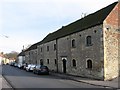
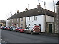
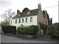
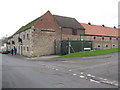
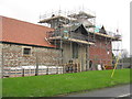
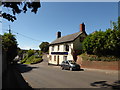
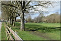
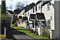
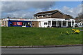
72 photos from this area
Area Information
Key information about the BA12 8NJ including its size, population, and administrative classification.
- Area Type
- Postcode
- Area Size
- 2.3 hectares
- Population
- 1344
- Population Density
- 5264 people/km²
House Prices in BA12 8NJ
67
Properties
£146,292
Average Sold Price
£87,000
Lowest Price
£210,000
Highest Price
Showing 67 properties
| Address | Type | Beds | Baths | Last Sale Price | Last Sale Date | |
|---|---|---|---|---|---|---|
| 82 Westleigh, Warminster, BA12 8NJ | Terraced | 2 | 1 | £173,000 | Sep 2025 | |
| 3, Pound Court, Westleigh, Warminster, BA12 8NJ | Flat | - | - | £114,000 | Jun 2025 | |
| 2, Pound Court, Westleigh, Warminster, BA12 8NJ | Maisonette | 1 | - | £95,000 | Sep 2024 | |
| 6, Pound Court, Westleigh, Warminster, BA12 8NJ | Flat | - | - | £89,500 | Oct 2023 | |
| 83 Westleigh, Warminster, BA12 8NJ | Terraced | 2 | 1 | £190,000 | Jul 2023 | |
| 4, Pound Court, Westleigh, Warminster, BA12 8NJ | Flat | - | - | £108,000 | Jun 2022 | |
| 103 Westleigh, Warminster, BA12 8NJ | house | 4 | - | £210,000 | Mar 2021 | |
| 74 Westleigh, Warminster, BA12 8NJ | Terraced | 3 | - | £179,000 | Nov 2018 | |
| 113 Westleigh, Warminster, BA12 8NJ | Terraced | 3 | - | £174,000 | May 2018 | |
| 62 Westleigh, Warminster, BA12 8NJ | Semi-detached | 4 | 1 | £182,500 | Sep 2016 |
Page 1 of 7
Energy Efficiency in BA12 8NJ
Amenities
Schools
| Rank | School | Type | Entry gender | Ages |
|---|
Explore more schools in this area
Go to Schools tabDemographics
Household Size
Two person
most common
Accommodation Type
Houses
most common
Tenure
64
majority
Ethnic Group
White
most common
Religion
N/A
most common
Household Composition
N/A
most common
Age
47
median
Adults (30-64 years)
most common
Household Deprivation
N/A
with no deprivation
NS-SEC
26
in Lower managerial occupations
Explore more demographic insights in this area
Go to Demographics tabPlanning
Planning Constraints
- Flood RiskPremium
- Ramsar Wetland SitesPremium
- Area of Outstanding Natural BeautyPremium
- Protected Nature ReservePremium
- Protected WoodlandPremium