Area Overview for BA12 8DF
Photos of BA12 8DF
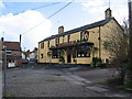
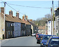
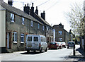
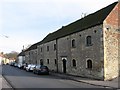
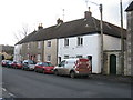
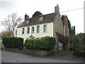
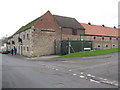
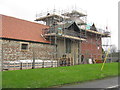
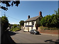
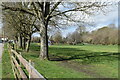
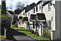
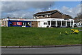
72 photos from this area
Area Information
Key information about the BA12 8DF including its size, population, and administrative classification.
- Area Type
- Postcode
- Area Size
- 1.3 hectares
- Population
- Not available
- Population Density
- Not available
House Prices in BA12 8DF
19
Properties
£256,095
Average Sold Price
£55,500
Lowest Price
£600,000
Highest Price
Showing 19 properties
| Address | Type | Beds | Baths | Last Sale Price | Last Sale Date | |
|---|---|---|---|---|---|---|
| 19 Bread Street, Warminster, BA12 8DF | house | - | - | £600,000 | Sep 2023 | |
| 21 Bread Street, Warminster, BA12 8DF | Retail | 3 | 1 | £320,000 | Oct 2022 | |
| Cley View Cottage, 16 Bread Street, Warminster, BA12 8DF | Detached | 4 | 2 | £512,500 | Apr 2022 | |
| 25A Bread Street, Warminster, BA12 8DF | Terraced | 3 | 1 | £270,500 | Dec 2021 | |
| 11 Bread Street, Warminster, BA12 8DF | Bungalow | 2 | - | £275,000 | Sep 2018 | |
| 25 Bread Street, Warminster, BA12 8DF | house | 3 | - | £135,000 | May 2014 | |
| 26 Bread Street, Warminster, BA12 8DF | house | - | - | £142,500 | Aug 2013 | |
| 22 Bread Street, Warminster, BA12 8DF | Terraced | - | - | £190,000 | Apr 2005 | |
| 24 Bread Street, Warminster, BA12 8DF | Terraced | 2 | 1 | £59,950 | Jan 2002 | |
| 26A Bread Street, Warminster, BA12 8DF | Terraced | - | - | £55,500 | Sep 1998 |
Page 1 of 2
Energy Efficiency in BA12 8DF
Amenities
Schools
| Rank | School | Type | Entry gender | Ages |
|---|
Explore more schools in this area
Go to Schools tabDemographics
Household Size
Two person
most common
Accommodation Type
Houses
most common
Tenure
64
majority
Ethnic Group
White
most common
Religion
N/A
most common
Household Composition
N/A
most common
Age
47
median
Adults (30-64 years)
most common
Household Deprivation
N/A
with no deprivation
NS-SEC
31
in Lower managerial occupations
Explore more demographic insights in this area
Go to Demographics tabPlanning
Planning Constraints
- Flood RiskPremium
- Ramsar Wetland SitesPremium
- Area of Outstanding Natural BeautyPremium
- Protected Nature ReservePremium
- Protected WoodlandPremium