Area Overview for BA12 8DE
Photos of BA12 8DE
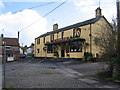
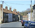
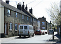
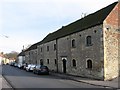
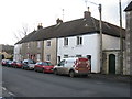
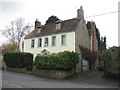
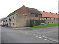
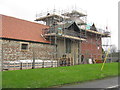
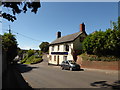
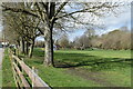
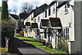
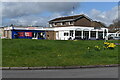
72 photos from this area
Area Information
Key information about the BA12 8DE including its size, population, and administrative classification.
- Area Type
- Postcode
- Area Size
- 3023 m²
- Population
- Not available
- Population Density
- Not available
House Prices in BA12 8DE
15
Properties
£145,318
Average Sold Price
£44,000
Lowest Price
£294,000
Highest Price
Showing 15 properties
| Address | Type | Beds | Baths | Last Sale Price | Last Sale Date | |
|---|---|---|---|---|---|---|
| Holly Cottage, 37 Bread Street, Warminster, BA12 8DE | house | 3 | 1 | £294,000 | Jan 2024 | |
| 5 Bread Street, Warminster, BA12 8DE | Terraced | 2 | 1 | £223,000 | Nov 2023 | |
| 7 Bread Street, Warminster, BA12 8DE | house | 2 | 1 | £197,000 | Jun 2023 | |
| LAND TO THE REAR OF 5 AND 6, BREAD STREET, Warminster, BA12 8DE | Land | - | - | £58,000 | Aug 2020 | |
| 8 Bread Street, Warminster, BA12 8DE | Terraced | 2 | 1 | £172,000 | Feb 2018 | |
| 34 Bread Street, Warminster, BA12 8DE | house | - | - | £165,000 | Sep 2016 | |
| 6 Bread Street, Warminster, BA12 8DE | Semi-detached | - | - | £164,000 | Sep 2016 | |
| 38 Bread Street, Warminster, BA12 8DE | Terraced | 2 | 1 | £135,500 | Oct 2014 | |
| 39 Bread Street, Warminster, BA12 8DE | Terraced | - | - | £77,500 | Aug 2002 | |
| 32 Bread Street, Warminster, BA12 8DE | Semi-detached | - | - | £68,500 | May 2000 |
Page 1 of 2
Energy Efficiency in BA12 8DE
Amenities
Schools
| Rank | School | Type | Entry gender | Ages |
|---|
Explore more schools in this area
Go to Schools tabDemographics
Household Size
Two person
most common
Accommodation Type
Houses
most common
Tenure
64
majority
Ethnic Group
White
most common
Religion
N/A
most common
Household Composition
N/A
most common
Age
47
median
Adults (30-64 years)
most common
Household Deprivation
N/A
with no deprivation
NS-SEC
31
in Lower managerial occupations
Explore more demographic insights in this area
Go to Demographics tabPlanning
Planning Constraints
- Flood RiskPremium
- Ramsar Wetland SitesPremium
- Area of Outstanding Natural BeautyPremium
- Protected Nature ReservePremium
- Protected WoodlandPremium