Area Overview for BA12 0HQ
Photos of BA12 0HQ
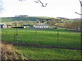
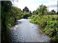
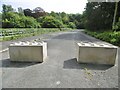
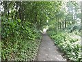
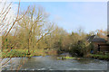
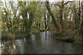
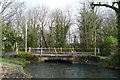
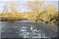
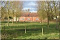
32 photos from this area
Area Information
Key information about the BA12 0HQ including its size, population, and administrative classification.
- Area Type
- Postcode
- Area Size
- 11.5 hectares
- Population
- 1215
- Population Density
- 16 people/km²
House Prices in BA12 0HQ
18
Properties
£512,000
Average Sold Price
£175,000
Lowest Price
£1,150,000
Highest Price
Showing 18 properties
| Address | Type | Beds | Baths | Last Sale Price | Last Sale Date | |
|---|---|---|---|---|---|---|
| The Forge, 113A Park Street, Heytesbury, BA12 0HQ | house | 2 | - | £575,000 | Sep 2021 | |
| 102 Park Street, Heytesbury, BA12 0HQ | Terraced | 3 | 3 | £280,000 | Sep 2021 | |
| 101 Park Street, Heytesbury, BA12 0HQ | Terraced | 4 | 3 | £380,000 | Mar 2020 | |
| 111 Park Street, Heytesbury, BA12 0HQ | Terraced | 2 | - | £175,000 | Oct 2013 | |
| Old Estate House, Park Street, Heytesbury, BA12 0HQ | Detached | - | - | £1,150,000 | Mar 2008 | |
| Old Forge House, 113 Park Street, Heytesbury, BA12 0HQ | Detached | 4 | 3 | - | - | |
| Pembroke Cottage, Park Street, Heytesbury, BA12 0HQ | Detached | 1 | 1 | - | - | |
| Tinkers Cottage, 105-106 Park Street, Heytesbury, BA12 0HQ | Detached | 2 | 2 | - | - | |
| 103 Park Street, Heytesbury, BA12 0HQ | house | - | - | - | - | |
| The Gate House, Park Street, Heytesbury, BA12 0HQ | Detached | 5 | 3 | - | - |
Page 1 of 2
Energy Efficiency in BA12 0HQ
Amenities
Schools
| Rank | School | Type | Entry gender | Ages |
|---|
Explore more schools in this area
Go to Schools tabDemographics
Household Size
Two person
most common
Accommodation Type
Houses
most common
Tenure
62
majority
Ethnic Group
White
most common
Religion
N/A
most common
Household Composition
N/A
most common
Age
47
median
Adults (30-64 years)
most common
Household Deprivation
N/A
with no deprivation
NS-SEC
39
in Lower managerial occupations
Explore more demographic insights in this area
Go to Demographics tabPlanning
Planning Constraints
- Flood RiskPremium
- Ramsar Wetland SitesPremium
- Area of Outstanding Natural BeautyPremium
- Protected Nature ReservePremium
- Protected WoodlandPremium