Area Overview for BA12 0HG
Photos of BA12 0HG
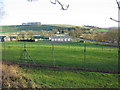
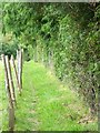
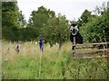
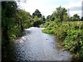
32 photos from this area
Area Information
Key information about the BA12 0HG including its size, population, and administrative classification.
- Area Type
- Postcode
- Area Size
- 46.7 hectares
- Population
- 1215
- Population Density
- 16 people/km²
House Prices in BA12 0HG
20
Properties
£580,063
Average Sold Price
£80,000
Lowest Price
£975,000
Highest Price
Showing 20 properties
| Address | Type | Beds | Baths | Last Sale Price | Last Sale Date | |
|---|---|---|---|---|---|---|
| The Walled Garden, 18 Heytesbury Park, Heytesbury, BA12 0HG | Detached | 4 | 2 | £925,000 | Aug 2023 | |
| 17 Heytesbury Park, Heytesbury, BA12 0HG | Detached | 4 | 2 | £970,000 | Feb 2023 | |
| 15 Heytesbury Park, Heytesbury, BA12 0HG | Detached | 4 | 3 | £975,000 | Nov 2022 | |
| South Lodge, 20 Heytesbury Park, Heytesbury, BA12 0HG | house | 4 | - | £617,500 | Jul 2012 | |
| 1, The Stables, Heytesbury Park, Heytesbury, BA12 0HG | Detached | 4 | 3 | £355,000 | Jul 2004 | |
| Dovecot House, 12 Heytesbury Park, Heytesbury, BA12 0HG | house | - | - | £495,000 | Mar 2004 | |
| 10, The Stables, Heytesbury Park, Heytesbury, BA12 0HG | house | - | - | £223,000 | Nov 1999 | |
| North Lodge, 19 Heytesbury Park, Heytesbury, BA12 0HG | Detached | - | - | £80,000 | Jul 1999 | |
| 6 Heytesbury Park, Heytesbury, BA12 0HG | Detached | 4 | 3 | - | - | |
| East Wing Penthouse, Heytesbury Park, Heytesbury, BA12 0HG | Flat | 3 | 2 | - | - |
Page 1 of 2
Energy Efficiency in BA12 0HG
Amenities
Schools
| Rank | School | Type | Entry gender | Ages |
|---|
Explore more schools in this area
Go to Schools tabDemographics
Household Size
Two person
most common
Accommodation Type
Houses
most common
Tenure
62
majority
Ethnic Group
White
most common
Religion
N/A
most common
Household Composition
N/A
most common
Age
47
median
Adults (30-64 years)
most common
Household Deprivation
N/A
with no deprivation
NS-SEC
39
in Lower managerial occupations
Explore more demographic insights in this area
Go to Demographics tabPlanning
Planning Constraints
- Flood RiskPremium
- Ramsar Wetland SitesPremium
- Area of Outstanding Natural BeautyPremium
- Protected Nature ReservePremium
- Protected WoodlandPremium