Area Overview for BA11 2XG
Photos of BA11 2XG
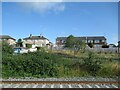
23 photos from this area
Area Information
Key information about the BA11 2XG including its size, population, and administrative classification.
- Area Type
- Postcode
- Area Size
- 8980 m²
- Population
- 1833
- Population Density
- 4772 people/km²
House Prices in BA11 2XG
18
Properties
£240,211
Average Sold Price
£71,500
Lowest Price
£400,000
Highest Price
Showing 18 properties
| Address | Type | Beds | Baths | Last Sale Price | Last Sale Date | |
|---|---|---|---|---|---|---|
| 22 Braithwaite Way, Frome, BA11 2XG | house | 4 | 1 | £400,000 | Aug 2023 | |
| 2 Braithwaite Way, Frome, BA11 2XG | Bungalow | 3 | 1 | £323,500 | Mar 2020 | |
| 9 Braithwaite Way, Frome, BA11 2XG | Bungalow | 3 | 1 | £305,000 | Oct 2018 | |
| 1 Braithwaite Way, Frome, BA11 2XG | Detached | 4 | 1 | £385,000 | Jun 2017 | |
| 12 Braithwaite Way, Frome, BA11 2XG | house | - | - | £300,000 | Jul 2016 | |
| 4 Braithwaite Way, Frome, BA11 2XG | house | - | - | £335,000 | Nov 2015 | |
| 16 Braithwaite Way, Frome, BA11 2XG | house | - | - | £262,000 | Sep 2015 | |
| 24 Braithwaite Way, Frome, BA11 2XG | Bungalow | - | - | £250,000 | Jun 2014 | |
| 10 Braithwaite Way, Frome, BA11 2XG | Detached | 3 | - | £199,950 | Dec 2013 | |
| 8 Braithwaite Way, Frome, BA11 2XG | Bungalow | 3 | 1 | £215,000 | Oct 2009 |
Page 1 of 2
Energy Efficiency in BA11 2XG
Amenities
Schools
| Rank | School | Type | Entry gender | Ages |
|---|
Explore more schools in this area
Go to Schools tabDemographics
Household Size
Two person
most common
Accommodation Type
Houses
most common
Tenure
87
majority
Ethnic Group
White
most common
Religion
N/A
most common
Household Composition
N/A
most common
Age
47
median
Adults (30-64 years)
most common
Household Deprivation
N/A
with no deprivation
NS-SEC
39
in Lower managerial occupations
Explore more demographic insights in this area
Go to Demographics tabPlanning
Planning Constraints
- Flood RiskPremium
- Ramsar Wetland SitesPremium
- Area of Outstanding Natural BeautyPremium
- Protected Nature ReservePremium
- Protected WoodlandPremium