Area Overview for BA11 2TJ
Photos of BA11 2TJ
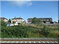
23 photos from this area
Area Information
Key information about the BA11 2TJ including its size, population, and administrative classification.
- Area Type
- Postcode
- Area Size
- 1.4 hectares
- Population
- Not available
- Population Density
- Not available
House Prices in BA11 2TJ
44
Properties
£166,192
Average Sold Price
£45,500
Lowest Price
£350,000
Highest Price
Showing 44 properties
| Address | Type | Beds | Baths | Last Sale Price | Last Sale Date | |
|---|---|---|---|---|---|---|
| 21 Chestnut Close, Frome, BA11 2TJ | Semi-detached | 3 | 1 | £292,500 | Nov 2025 | |
| 10 Chestnut Close, Frome, BA11 2TJ | Terraced | 3 | - | £245,000 | Feb 2025 | |
| 30 Chestnut Close, Frome, BA11 2TJ | Terraced | 1 | 1 | £225,000 | Jan 2023 | |
| 16 Chestnut Close, Frome, BA11 2TJ | house | 3 | 1 | £254,000 | Jun 2022 | |
| 31 Chestnut Close, Frome, BA11 2TJ | Semi-detached | 4 | 1 | £350,000 | Mar 2022 | |
| 6 Chestnut Close, Frome, BA11 2TJ | Terraced | 3 | 1 | £215,000 | Nov 2020 | |
| 42 Chestnut Close, Frome, BA11 2TJ | house | - | - | £280,000 | Oct 2019 | |
| 29 Chestnut Close, Frome, BA11 2TJ | house | 3 | 1 | £222,000 | Sep 2019 | |
| 24 Chestnut Close, Frome, BA11 2TJ | Terraced | 4 | 2 | £265,000 | Apr 2019 | |
| 1 Chestnut Close, Frome, BA11 2TJ | house | 3 | - | £114,444 | Oct 2018 |
Page 1 of 5
Energy Efficiency in BA11 2TJ
Amenities
Schools
| Rank | School | Type | Entry gender | Ages |
|---|
Explore more schools in this area
Go to Schools tabDemographics
Household Size
Two person
most common
Accommodation Type
Houses
most common
Tenure
77
majority
Ethnic Group
White
most common
Religion
N/A
most common
Household Composition
N/A
most common
Age
47
median
Adults (30-64 years)
most common
Household Deprivation
N/A
with no deprivation
NS-SEC
34
in Lower managerial occupations
Explore more demographic insights in this area
Go to Demographics tabPlanning
Planning Constraints
- Flood RiskPremium
- Ramsar Wetland SitesPremium
- Area of Outstanding Natural BeautyPremium
- Protected Nature ReservePremium
- Protected WoodlandPremium