Area Overview for BA11 2QE
Photos of BA11 2QE
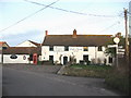
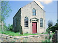
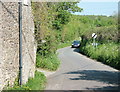
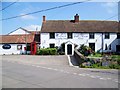
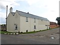
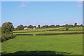
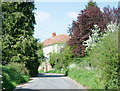
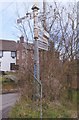

11 photos from this area
Area Information
Key information about the BA11 2QE including its size, population, and administrative classification.
- Area Type
- Postcode
- Area Size
- 20.9 hectares
- Population
- 1454
- Population Density
- 85 people/km²
House Prices in BA11 2QE
18
Properties
£417,095
Average Sold Price
£195,000
Lowest Price
£620,000
Highest Price
Showing 18 properties
| Address | Type | Beds | Baths | Last Sale Price | Last Sale Date | |
|---|---|---|---|---|---|---|
| Tiko, Rudge Lane, Rudge, Frome, BA11 2QE | Detached | 3 | 1 | £620,000 | Aug 2025 | |
| Jasmine Cottage, Rudge Lane, Rudge, Frome, BA11 2QE | Cottage | 3 | 2 | £530,000 | Mar 2025 | |
| Cosy Cottage, Rudge Lane, Rudge, Frome, BA11 2QE | Semi-detached | - | - | £507,500 | Aug 2020 | |
| Hornbeam Cottage, Rudge Lane, Rudge, Frome, BA11 2QE | Semi-detached | 3 | 2 | £540,000 | Mar 2018 | |
| Chapel Cottage, Rudge Lane, Rudge, Frome, BA11 2QE | house | 3 | - | £420,000 | Nov 2011 | |
| Weavers Cottage, Rudge Lane, Rudge, Frome, BA11 2QE | house | 3 | - | £387,500 | Oct 2011 | |
| Chapel House, Rudge Lane, Rudge, Frome, BA11 2QE | Semi-detached | - | - | £341,000 | Nov 2006 | |
| Ivy Cottage, Rudge Lane, Rudge, Frome, BA11 2QE | Semi-detached | - | - | £249,950 | Apr 2006 | |
| Springfield, Rudge Lane, Rudge, Frome, BA11 2QE | Detached | - | - | £380,000 | Jul 2004 | |
| Hyland House, Rudge Lane, Rudge, Frome, BA11 2QE | Detached | - | - | £195,000 | May 1999 |
Page 1 of 2
Energy Efficiency in BA11 2QE
Amenities
Schools
| Rank | School | Type | Entry gender | Ages |
|---|
Explore more schools in this area
Go to Schools tabDemographics
Household Size
Two person
most common
Accommodation Type
Houses
most common
Tenure
80
majority
Ethnic Group
White
most common
Religion
N/A
most common
Household Composition
N/A
most common
Age
47
median
Adults (30-64 years)
most common
Household Deprivation
N/A
with no deprivation
NS-SEC
45
in Lower managerial occupations
Explore more demographic insights in this area
Go to Demographics tabPlanning
Planning Constraints
- Flood RiskPremium
- Ramsar Wetland SitesPremium
- Area of Outstanding Natural BeautyPremium
- Protected Nature ReservePremium
- Protected WoodlandPremium