Area Overview for BA13 4EG
Photos of BA13 4EG
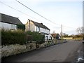
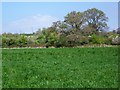
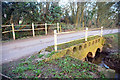
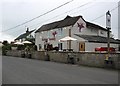
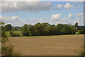
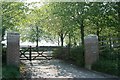
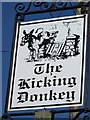
12 photos from this area
Area Information
Key information about the BA13 4EG including its size, population, and administrative classification.
- Area Type
- Postcode
- Area Size
- 81.8 hectares
- Population
- 1278
- Population Density
- 112 people/km²
House Prices in BA13 4EG
17
Properties
£474,619
Average Sold Price
£51,500
Lowest Price
£1,150,000
Highest Price
Showing 17 properties
| Address | Type | Beds | Baths | Last Sale Price | Last Sale Date | |
|---|---|---|---|---|---|---|
| The Mead, Brokerswood, Brokerswood, BA13 4EG | house | 2 | 2 | £1,150,000 | Feb 2025 | |
| Yew Tree House, Brokerswood, Brokerswood, BA13 4EG | house | - | - | £877,500 | Apr 2019 | |
| 2, Yew Tree Cottages, Brokerswood, Brokerswood, BA13 4EG | house | - | - | £280,000 | Sep 2013 | |
| Woodside Cottage, Brokerswood, Brokerswood, BA13 4EG | house | 4 | - | £578,000 | May 2010 | |
| Green Pastures, Brokerswood, Brokerswood, BA13 4EG | Detached | - | - | £155,000 | Aug 2003 | |
| Abingdon House, Brokerswood, Brokerswood, BA13 4EG | Detached | 5 | - | £515,000 | Jun 2000 | |
| Fern Cottage, Brokerswood, Brokerswood, BA13 4EG | house | - | - | £189,950 | Nov 1997 | |
| 1, Yew Tree Cottages, Brokerswood, Brokerswood, BA13 4EG | Detached | 5 | - | £51,500 | Sep 1995 | |
| Staff Accommodation, The Kicking Donkey, Brokerswood, Brokerswood, BA13 4EG | Flat | - | - | - | - | |
| Barn At Honeybridge, Brokerswood, Brokerswood, BA13 4EG | undefined | - | - | - | - |
Page 1 of 2
Energy Efficiency in BA13 4EG
Amenities
Schools
| Rank | School | Type | Entry gender | Ages |
|---|
Explore more schools in this area
Go to Schools tabDemographics
Household Size
Two person
most common
Accommodation Type
Houses
most common
Tenure
86
majority
Ethnic Group
White
most common
Religion
N/A
most common
Household Composition
N/A
most common
Age
47
median
Adults (30-64 years)
most common
Household Deprivation
N/A
with no deprivation
NS-SEC
41
in Lower managerial occupations
Explore more demographic insights in this area
Go to Demographics tabPlanning
Planning Constraints
- Flood RiskPremium
- Ramsar Wetland SitesPremium
- Area of Outstanding Natural BeautyPremium
- Protected Nature ReservePremium
- Protected WoodlandPremium