Area Overview for BA1 9AZ
Photos of BA1 9AZ
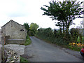
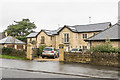
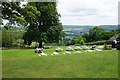
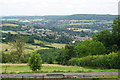
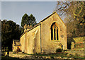
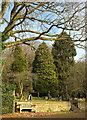
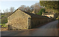
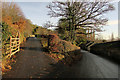
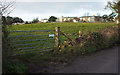
61 photos from this area
Area Information
Key information about the BA1 9AZ including its size, population, and administrative classification.
- Area Type
- Postcode
- Area Size
- 1.1 hectares
- Population
- 2485
- Population Density
- 1099 people/km²
House Prices in BA1 9AZ
24
Properties
£576,980
Average Sold Price
£175,000
Lowest Price
£915,750
Highest Price
Showing 24 properties
| Address | Type | Beds | Baths | Last Sale Price | Last Sale Date | |
|---|---|---|---|---|---|---|
| 15 Hopton Way, Lansdown, Bath, BA1 9AZ | Detached | 4 | 2 | £175,000 | Feb 2025 | |
| 22 Hopton Way, Lansdown, Bath, BA1 9AZ | Semi-detached | 3 | 2 | £580,000 | Jan 2025 | |
| 21 Hopton Way, Lansdown, Bath, BA1 9AZ | Semi-detached | 3 | 2 | £595,000 | Dec 2023 | |
| 16 Hopton Way, Lansdown, Bath, BA1 9AZ | house | - | - | £635,000 | Aug 2021 | |
| 12 Hopton Way, Lansdown, Bath, BA1 9AZ | Detached | 4 | 3 | £615,000 | Jun 2021 | |
| 14 Hopton Way, Lansdown, Bath, BA1 9AZ | Detached | 4 | 2 | £619,995 | Jun 2021 | |
| 11 Hopton Way, Lansdown, Bath, BA1 9AZ | house | - | - | £670,000 | Jan 2021 | |
| 10 Hopton Way, Lansdown, Bath, BA1 9AZ | Detached | 4 | 3 | £715,000 | Dec 2020 | |
| 17 Hopton Way, Lansdown, Bath, BA1 9AZ | house | - | - | £715,000 | Aug 2020 | |
| 27 Hopton Way, Lansdown, Bath, BA1 9AZ | house | 5 | 3 | £915,750 | Sep 2019 |
Page 1 of 3
Energy Efficiency in BA1 9AZ
Amenities
Schools
| Rank | School | Type | Entry gender | Ages |
|---|
Explore more schools in this area
Go to Schools tabDemographics
Household Size
Two person
most common
Accommodation Type
Houses
most common
Tenure
81
majority
Ethnic Group
White
most common
Religion
N/A
most common
Household Composition
N/A
most common
Age
47
median
Adults (30-64 years)
most common
Household Deprivation
N/A
with no deprivation
NS-SEC
58
in Lower managerial occupations
Explore more demographic insights in this area
Go to Demographics tabPlanning
Planning Constraints
- Flood RiskPremium
- Ramsar Wetland SitesPremium
- Area of Outstanding Natural BeautyPremium
- Protected Nature ReservePremium
- Protected WoodlandPremium