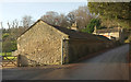
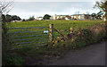
Area Overview for BA1 9AY
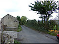
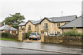
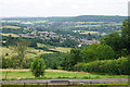
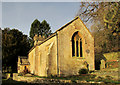
Photos of BA1 9AY


Area Information
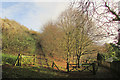
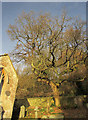
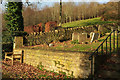
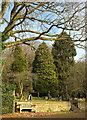
Living in BA1 9AY places you within a compact residential cluster in the Lansdown district of Bath. This specific postcode covers an area of only 8,036 square metres and is home to 2,485 residents. The location sits north of the city centre, extending up Lansdown Hill amidst the historic fabric of Bath & North East Somerset. You are situated in an established neighbourhood where daily life balances the quiet of a small estate with the convenience of a Global Heritage City nearby. The site density stands at roughly 1,099 people per square kilometre, indicating a moderately populated but space-conscious environment. Residents here enjoy proximity to Grade I listed Lansdown Crescent, a Georgian architectural ensemble that overlooks central Bath from the hilltop. While the postcode itself holds a small footprint, it connects you to broader landmarks such as Lansdown Cemetery, established in 1760, and Beckford's Tower. The area retains historical significance, having hosted the Battle of Lansdowne in 1643 and later serving as a favoured address for figures like William Beckford. Piecing together these details, your daily routine involves walking past well-preserved Georgian facades and accessing shops in Bath city centre or at nearby railway stations. The character is defined by its heritage and its position as a hilltop suburb offering views rather than flat, sprawling development.
- Area Type
- Postcode
- Area Size
- 8036 m²
- Population
- 2485
- Population Density
- 1099 people/km²
The property market in BA1 9AY is characterised by a stock that is overwhelmingly owner-occupied. Home ownership reaches 81 per cent within this specific postcode, a figure that signals a market driven by owner-builders and long-term residents. The primary accommodation type here is houses, meaning you are unlikely to find flats or rental blocks dominating the streets. This high level of tenure suggests a stable segment of the market where chains are often shorter and sales are more predictable. When searching for homes in BA1 9AY, you are targeting a small, specific cluster rather than a broad district. The residential nature of the area means the streetscape will be defined by domestic architecture rather than commercial development. This contrasts with parts of the city centre where commercial and residential spaces might mix more densely. The area size of 8,036 square metres limits the supply, creating a niche market where each property is distinct. Buyers looking at this postcode should expect a traditional market where properties are sold as freehold houses rather than leasehold apartments. The 81 per cent ownership rate also implies that mortgage lenders may view this area as low risk due to the stability of the resident base.
House Prices in BA1 9AY
Showing 11 properties
| Address | Type | Beds | Baths | Last Sale Price | Last Sale Date | |
|---|---|---|---|---|---|---|
| 8 The Furlong, Lansdown, Bath, BA1 9AY | Detached | 5 | 3 | - | - | |
| 10 The Furlong, Lansdown, Bath, BA1 9AY | house | - | - | - | - | |
| 1 The Furlong, Lansdown, Bath, BA1 9AY | house | - | - | - | - | |
| 7 The Furlong, Lansdown, Bath, BA1 9AY | house | - | - | - | - | |
| 6 The Furlong, Lansdown, Bath, BA1 9AY | house | - | - | - | - | |
| 2 The Furlong, Lansdown, Bath, BA1 9AY | house | - | - | - | - | |
| 5 The Furlong, Lansdown, Bath, BA1 9AY | house | - | - | - | - | |
| 9 The Furlong, Lansdown, Bath, BA1 9AY | house | - | - | - | - | |
| 4 The Furlong, Lansdown, Bath, BA1 9AY | house | - | - | - | - | |
| 3 The Furlong, Lansdown, Bath, BA1 9AY | house | - | - | - | - |
Energy Efficiency in BA1 9AY
Your lifestyle in BA1 9AY is shaped by convenient access to retail and rail amenities, all within walking distance. For daily shopping, you have Spar, Tesco Bath, and Spar Brookside located nearby. These five retail venues cover your essentials from groceries to household goods, meaning you rarely need to travel far for supplies. Transport convenience is equally high, with five railway options including Oldfield Park Railway Station, Bath Spa Railway Station, and Keynsham Railway Station just a short trip away. You also have access to two Metro stops serving Bitton and Oldland, providing additional flexibility for longer journeys. The nearby reservoirs at Bitton and Oldand offer open spaces for recreation, adding a green dimension to your weekend activities. This blend of urban retail and accessible rail networks creates a balanced routine where you can commute to work easily or manage local errands without stress. The area does not rely on a single shopping centre but benefits from a distributed network of services. You can walk to Tesco Bath for larger hauls or visit Spar for quick stops, then catch a train from the multiple nearby stations. This infrastructure supports a self-sufficient lifestyle where daily needs are met locally, while major destinations remain easily reachable by rail.
Amenities
Schools
Families considering BA1 9AY will find a strong educational infrastructure nearby, offering a mix of independent and academy options. The area provides direct access to Kingswood School, which is designated as an independent institution. You can also reach Royal High School GDST, another independent school, and Kingswood Preparatory School if you are looking for younger children or a range of educational stages. For state education, Abbot Alphege Academy serves the locality and holds an Ofsted rating of satisfactory. This combination of schools allows you to choose based on your educational philosophy or budget. The presence of multiple independent schools alongside a state academy indicates a diverse sector serving different family needs. While none of the listed institutions carry a "good" or "outstanding" Ofsted rating in the provided data, the availability of independent options generally correlates with high academic standards in the region. The mix of school types means you can access elite private education or maintain your place in the public system within close proximity. Selecting a home in BA1 9AY places you within commuting distance of these key educational hubs, ensuring children have several quality choices without complex travel arrangements.
| Rank | School | Type | Entry gender | Ages |
|---|
Explore more schools in this area
Go to Schools tabDemographics
The community in BA1 9AY is stable and predominantly settled, with a median age of 47 years. The most common age range comprises adults between 30 and 64, suggesting a neighbourhood where families and established professionals have put down roots. Home ownership stands at a high 81 per cent, indicating that the vast majority of residents are free from the uncertainty of renting. This statistic aligns with the accommodation type, which consists primarily of houses rather than flats or purpose-built estates. The demographic profile reflects a relatively homogenous population, with White residents forming the predominant ethnic group. You are entering a market where long-term stability is the norm rather than the exception. The high home ownership rate of 81 percent implies that prices likely reflect the value of the property itself rather than rental yields, a key factor for serious buyers. The age distribution of adults aged 30 to 64 further suggests a mature community where schools and family facilities are central to local life. There is little transient population noise here; instead, the area functions as a residential stronghold for those seeking permanence. The data points to a place where neighbours know one another and property values are sustained by deep community attachment rather than speculative investment.
Household Size
Accommodation Type
Tenure
Ethnic Group
Religion
Household Composition
Age
Household Deprivation
NS-SEC
Explore more demographic insights in this area
Go to Demographics tabPlanning
Planning Constraints
- Flood RiskPremium
- Ramsar Wetland SitesPremium
- Area of Outstanding Natural BeautyPremium
- Protected Nature ReservePremium
- Protected WoodlandPremium