Area Overview for BA1 4EJ
Photos of BA1 4EJ
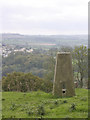
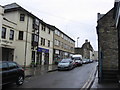
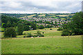
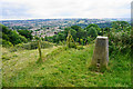


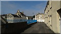
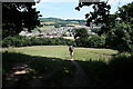
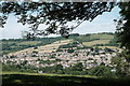
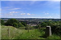


52 photos from this area
Area Information
Key information about the BA1 4EJ including its size, population, and administrative classification.
- Area Type
- Postcode
- Area Size
- 1.2 hectares
- Population
- 1581
- Population Density
- 1881 people/km²
House Prices in BA1 4EJ
54
Properties
£220,479
Average Sold Price
£59,950
Lowest Price
£373,500
Highest Price
Showing 54 properties
| Address | Type | Beds | Baths | Last Sale Price | Last Sale Date | |
|---|---|---|---|---|---|---|
| 44 Frankland Close, Lower Weston, Bath, BA1 4EJ | house | - | - | £350,000 | Aug 2024 | |
| 50 Frankland Close, Lower Weston, Bath, BA1 4EJ | house | - | - | £360,000 | Aug 2023 | |
| 28 Frankland Close, Lower Weston, Bath, BA1 4EJ | house | 3 | - | £345,000 | May 2023 | |
| 14 Frankland Close, Lower Weston, Bath, BA1 4EJ | house | 3 | 1 | £373,500 | Mar 2023 | |
| 20 Frankland Close, Lower Weston, Bath, BA1 4EJ | Terraced | 2 | 1 | £280,000 | Dec 2021 | |
| 23 Frankland Close, Lower Weston, Bath, BA1 4EJ | house | 2 | 1 | £272,500 | Oct 2020 | |
| 27 Frankland Close, Lower Weston, Bath, BA1 4EJ | Semi-detached | 3 | 1 | £290,000 | Feb 2020 | |
| 36 Frankland Close, Lower Weston, Bath, BA1 4EJ | house | - | - | £260,000 | Jun 2019 | |
| 39 Frankland Close, Lower Weston, Bath, BA1 4EJ | Terraced | 3 | 1 | £315,000 | Jun 2018 | |
| 53 Frankland Close, Lower Weston, Bath, BA1 4EJ | house | - | - | £272,000 | Apr 2018 |
Page 1 of 6
Energy Efficiency in BA1 4EJ
Amenities
Schools
| Rank | School | Type | Entry gender | Ages |
|---|
Explore more schools in this area
Go to Schools tabDemographics
Household Size
One person
most common
Accommodation Type
Houses
most common
Tenure
63
majority
Ethnic Group
White
most common
Religion
N/A
most common
Household Composition
N/A
most common
Age
47
median
Adults (30-64 years)
most common
Household Deprivation
N/A
with no deprivation
NS-SEC
47
in Lower managerial occupations
Explore more demographic insights in this area
Go to Demographics tabPlanning
Planning Constraints
- Flood RiskPremium
- Ramsar Wetland SitesPremium
- Area of Outstanding Natural BeautyPremium
- Protected Nature ReservePremium
- Protected WoodlandPremium