Area Overview for BA1 3RQ
Photos of BA1 3RQ
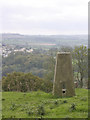
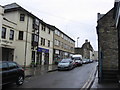
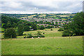
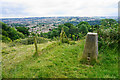
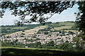
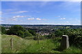
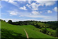

52 photos from this area
Area Information
Key information about the BA1 3RQ including its size, population, and administrative classification.
- Area Type
- Postcode
- Area Size
- 1.2 hectares
- Population
- 1581
- Population Density
- 1881 people/km²
House Prices in BA1 3RQ
30
Properties
£349,737
Average Sold Price
£147,000
Lowest Price
£675,000
Highest Price
Showing 30 properties
| Address | Type | Beds | Baths | Last Sale Price | Last Sale Date | |
|---|---|---|---|---|---|---|
| 89 Penn Lea Road, Lower Weston, Bath, BA1 3RQ | Semi-detached | 5 | - | £675,000 | Oct 2022 | |
| 95 Penn Lea Road, Lower Weston, Bath, BA1 3RQ | house | - | - | £650,000 | Oct 2022 | |
| 97 Penn Lea Road, Lower Weston, Bath, BA1 3RQ | Semi-detached | 3 | 1 | £500,000 | Jan 2018 | |
| 67 Penn Lea Road, Lower Weston, Bath, BA1 3RQ | Semi-detached | 3 | 1 | £470,000 | Dec 2017 | |
| 91 Penn Lea Road, Lower Weston, Bath, BA1 3RQ | Semi-detached | 4 | 2 | £432,500 | Oct 2014 | |
| 93 Penn Lea Road, Lower Weston, Bath, BA1 3RQ | Semi-detached | 4 | - | £400,000 | Apr 2013 | |
| 111 Penn Lea Road, Lower Weston, Bath, BA1 3RQ | Semi-detached | 3 | - | £300,000 | Feb 2013 | |
| 77 Penn Lea Road, Lower Weston, Bath, BA1 3RQ | house | - | - | £300,000 | Aug 2009 | |
| 75 Penn Lea Road, Lower Weston, Bath, BA1 3RQ | house | - | - | £393,000 | Sep 2008 | |
| 99 Penn Lea Road, Lower Weston, Bath, BA1 3RQ | Semi-detached | - | - | £375,000 | Oct 2007 |
Page 1 of 3
Energy Efficiency in BA1 3RQ
Amenities
Schools
| Rank | School | Type | Entry gender | Ages |
|---|
Explore more schools in this area
Go to Schools tabDemographics
Household Size
One person
most common
Accommodation Type
Houses
most common
Tenure
63
majority
Ethnic Group
White
most common
Religion
N/A
most common
Household Composition
N/A
most common
Age
47
median
Adults (30-64 years)
most common
Household Deprivation
N/A
with no deprivation
NS-SEC
47
in Lower managerial occupations
Explore more demographic insights in this area
Go to Demographics tabPlanning
Planning Constraints
- Flood RiskPremium
- Ramsar Wetland SitesPremium
- Area of Outstanding Natural BeautyPremium
- Protected Nature ReservePremium
- Protected WoodlandPremium