Area Overview for Pulborough
Photos of Pulborough


Area Information
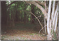
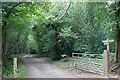
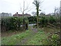
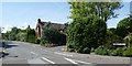
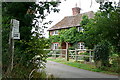
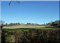
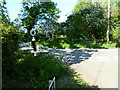
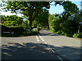
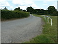
Living in Pulborough reveals a distinct character defined by its rural setting and civil parish status. The area covers 21.0 km², offering a landscape that feels spacious rather than densely packed. You will find a community where the pace of life slows down, suitable for those seeking a quiet retreat away from urban noise. This location in England provides a stable environment for families or retirees who value privacy and open space. The size of the parish suggests ample room for gardens and outdoor activities, which aligns with the lifestyle preferences of the current residents. Daily life here revolves around local amenities that serve this compact yet functional community. Unlike sprawling metropolitan developments, Pulborough maintains its identity through managed growth and established boundaries. Prospective buyers visiting homes in Pulborough notice a lack of high-density developments. The visual appeal comes from the integration of natural features with residential properties. You do not experience the congestion common in larger towns, yet you remain connected to the wider region. The terrain supports a variety of housing styles, from traditional cottages to modern builds that respect the local aesthetic. This balance between isolation and accessibility makes Pulborough a practical choice for those prioritising a peaceful domestic setting. The sheer scale of the parish ensures that green spaces remain a central part of everyday life for everyone residing there.
- Area Type
- Parish
- Area Size
- 21.0 km²
- Population
- Not available
- Population Density
- Not available
Demographics
The community profile of Pulborough tells a clear story about who calls this place home. The median age reaches 70, indicating that older adults form a significant portion of the local population. This age distribution shapes the social fabric, creating a neighbourly environment where established routines and traditions likely hold strong. Home ownership stands at 70%, reflecting a settled population that has put down roots over many years. Such high ownership rates typically correlate with long-term residents who prioritize stability over the flexibility of renting. You will find that the household composition reflects these demographic shifts, with larger family units potentially giving way to smaller households dominated by retirees. The accommodation types available cater primarily to this mature age group, though specific breakdowns by property style remain part of the broader housing stock picture. Diversity in terms of ethnicity and religious affiliation contributes to the overall cultural mosaic of the parish, even if specific figures are not detailed in this snapshot. The low median age suggests a slower rate of youth influx compared to industrial or university towns. This steady demographic structure means you are entering a market where the needs of older buyers often dictate property trends. Living here means joining a community where life experience is valued and the social network is likely deep and enduring.
Household Size
Accommodation Type
Tenure
Ethnic Group
Religion
Household Composition
Age
Household Deprivation
NS-SEC
Explore more demographic insights in this area
Go to Demographics tabPlanning
Planning Constraints
- Flood RiskPremium
- Area of Outstanding Natural BeautyPremium
- Protected WoodlandPremium