Area Overview for TW20 0BA
Photos of TW20 0BA
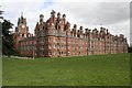
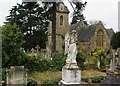
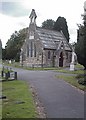
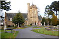

100 photos from this area
Area Information
Key information about the TW20 0BA including its size, population, and administrative classification.
- Area Type
- Postcode
- Area Size
- 7.6 hectares
- Population
- 1533
- Population Density
- 5100 people/km²
House Prices in TW20 0BA
61
Properties
£825,670
Average Sold Price
£199,995
Lowest Price
£1,540,000
Highest Price
Showing 61 properties
| Address | Type | Beds | Baths | Last Sale Price | Last Sale Date | |
|---|---|---|---|---|---|---|
| 38 St Davids Drive, Englefield Green, TW20 0BA | Semi-detached | - | - | £364,500 | Oct 2024 | |
| 52 St Davids Drive, Englefield Green, TW20 0BA | Semi-detached | 5 | 3 | £900,000 | Jan 2024 | |
| 50 St Davids Drive, Englefield Green, TW20 0BA | Terraced | 4 | 3 | £980,000 | Sep 2023 | |
| 36 St Davids Drive, Englefield Green, TW20 0BA | Detached | 5 | 5 | £1,540,000 | Aug 2023 | |
| 16 St Davids Drive, Englefield Green, TW20 0BA | house | 4 | - | £1,190,000 | Jan 2023 | |
| 42 St Davids Drive, Englefield Green, TW20 0BA | Retail | 5 | 3 | £1,015,000 | Jul 2022 | |
| 2 St Davids Drive, Englefield Green, TW20 0BA | Flat | 2 | 2 | £435,000 | Jul 2022 | |
| 30 St Davids Drive, Englefield Green, TW20 0BA | Detached | 6 | - | £1,219,000 | Jun 2022 | |
| 20 St Davids Drive, Englefield Green, TW20 0BA | Semi-detached | 5 | - | £955,000 | Feb 2022 | |
| 29 St Davids Drive, Englefield Green, TW20 0BA | house | - | - | £1,280,000 | Jun 2021 |
Page 1 of 7
Energy Efficiency in TW20 0BA
Amenities
Schools
| Rank | School | Type | Entry gender | Ages |
|---|
Explore more schools in this area
Go to Schools tabDemographics
Household Size
Family (3-5 people)
most common
Accommodation Type
Houses
most common
Tenure
45
majority
Ethnic Group
White
most common
Religion
N/A
most common
Household Composition
N/A
most common
Age
47
median
Adults (30-64 years)
most common
Household Deprivation
N/A
with no deprivation
NS-SEC
37
in Lower managerial occupations
Explore more demographic insights in this area
Go to Demographics tabPlanning
Planning Constraints
- Flood RiskPremium
- Ramsar Wetland SitesPremium
- Area of Outstanding Natural BeautyPremium
- Protected Nature ReservePremium
- Protected WoodlandPremium