Area Overview for TW19 7SE
Photos of TW19 7SE
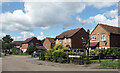
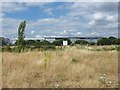
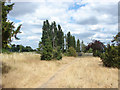
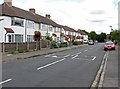
37 photos from this area
Area Information
Key information about the TW19 7SE including its size, population, and administrative classification.
- Area Type
- Postcode
- Area Size
- 1.1 hectares
- Population
- 1978
- Population Density
- 6692 people/km²
House Prices in TW19 7SE
42
Properties
£280,663
Average Sold Price
£155,000
Lowest Price
£495,000
Highest Price
Showing 42 properties
| Address | Type | Beds | Baths | Last Sale Price | Last Sale Date | |
|---|---|---|---|---|---|---|
| 166 Viola Avenue, Stanwell, TW19 7SE | Detached | 3 | 1 | £450,000 | Sep 2025 | |
| 128 Viola Avenue, Stanwell, TW19 7SE | Terraced | 4 | 1 | £495,000 | Jul 2025 | |
| 150 Viola Avenue, Stanwell, TW19 7SE | Semi-detached | 4 | 1 | £440,000 | Feb 2024 | |
| 144 Viola Avenue, Stanwell, TW19 7SE | Maisonette | - | - | £250,000 | Jul 2017 | |
| 108 Viola Avenue, Stanwell, TW19 7SE | house | 4 | - | £329,000 | Apr 2017 | |
| 158 Viola Avenue, Stanwell, TW19 7SE | Terraced | 3 | - | £355,000 | Jul 2016 | |
| 170 Viola Avenue, Stanwell, TW19 7SE | Terraced | 2 | - | £250,000 | May 2014 | |
| 136 Viola Avenue, Stanwell, TW19 7SE | Semi-detached | 3 | - | £243,000 | Jan 2014 | |
| 164 Viola Avenue, Stanwell, TW19 7SE | house | 4 | - | £240,000 | Dec 2011 | |
| 152 Viola Avenue, Stanwell, TW19 7SE | house | 4 | - | £187,000 | Oct 2010 |
Page 1 of 5
Energy Efficiency in TW19 7SE
Amenities
Schools
| Rank | School | Type | Entry gender | Ages |
|---|
Explore more schools in this area
Go to Schools tabDemographics
Household Size
Family (3-5 people)
most common
Accommodation Type
Houses
most common
Tenure
51
majority
Ethnic Group
White
most common
Religion
N/A
most common
Household Composition
N/A
most common
Age
47
median
Adults (30-64 years)
most common
Household Deprivation
N/A
with no deprivation
NS-SEC
27
in Lower managerial occupations
Explore more demographic insights in this area
Go to Demographics tabPlanning
Planning Constraints
- Flood RiskPremium
- Ramsar Wetland SitesPremium
- Area of Outstanding Natural BeautyPremium
- Protected Nature ReservePremium
- Protected WoodlandPremium