Area Overview for TW19 7HF
Photos of TW19 7HF
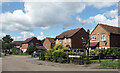
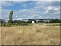
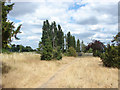
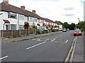
37 photos from this area
Area Information
Key information about the TW19 7HF including its size, population, and administrative classification.
- Area Type
- Postcode
- Area Size
- 1.0 hectares
- Population
- 1863
- Population Density
- 3330 people/km²
House Prices in TW19 7HF
12
Properties
£244,990
Average Sold Price
£76,000
Lowest Price
£372,000
Highest Price
Showing 12 properties
| Address | Type | Beds | Baths | Last Sale Price | Last Sale Date | |
|---|---|---|---|---|---|---|
| 34 Hadrian Way, Stanwell, TW19 7HF | house | - | - | £355,000 | Feb 2022 | |
| 38 Hadrian Way, Stanwell, TW19 7HF | house | - | - | £315,000 | Aug 2019 | |
| 30 Hadrian Way, Stanwell, TW19 7HF | Semi-detached | 3 | - | £372,000 | Jun 2016 | |
| 24 Hadrian Way, Stanwell, TW19 7HF | Semi-detached | 3 | - | £292,000 | Dec 2014 | |
| 28 Hadrian Way, Stanwell, TW19 7HF | house | - | - | £240,000 | Aug 2012 | |
| 40 Hadrian Way, Stanwell, TW19 7HF | house | - | - | £209,950 | Feb 2010 | |
| 26 Hadrian Way, Stanwell, TW19 7HF | Semi-detached | - | - | £224,950 | Nov 2006 | |
| 18 Hadrian Way, Stanwell, TW19 7HF | Terraced | 3 | - | £185,000 | Feb 2006 | |
| 22 Hadrian Way, Stanwell, TW19 7HF | Terraced | - | - | £180,000 | Jun 2005 | |
| 32 Hadrian Way, Stanwell, TW19 7HF | Terraced | 3 | 2 | £76,000 | Nov 1997 |
Page 1 of 2
Energy Efficiency in TW19 7HF
Amenities
Schools
| Rank | School | Type | Entry gender | Ages |
|---|
Explore more schools in this area
Go to Schools tabDemographics
Household Size
Family (3-5 people)
most common
Accommodation Type
Houses
most common
Tenure
55
majority
Ethnic Group
White
most common
Religion
N/A
most common
Household Composition
N/A
most common
Age
47
median
Adults (30-64 years)
most common
Household Deprivation
N/A
with no deprivation
NS-SEC
25
in Lower managerial occupations
Explore more demographic insights in this area
Go to Demographics tabPlanning
Planning Constraints
- Flood RiskPremium
- Ramsar Wetland SitesPremium
- Area of Outstanding Natural BeautyPremium
- Protected Nature ReservePremium
- Protected WoodlandPremium