Area Overview for TW19 7DT
Photos of TW19 7DT
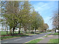
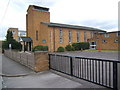
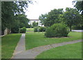
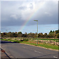
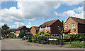
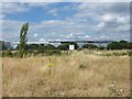
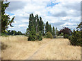
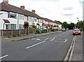
37 photos from this area
Area Information
Key information about the TW19 7DT including its size, population, and administrative classification.
- Area Type
- Postcode
- Area Size
- 4801 m²
- Population
- 1863
- Population Density
- 3330 people/km²
House Prices in TW19 7DT
19
Properties
£274,111
Average Sold Price
£61,000
Lowest Price
£470,000
Highest Price
Showing 19 properties
| Address | Type | Beds | Baths | Last Sale Price | Last Sale Date | |
|---|---|---|---|---|---|---|
| 141 Clare Road, Stanwell, TW19 7DT | house | - | - | £470,000 | Jan 2023 | |
| 145 Clare Road, Stanwell, TW19 7DT | Terraced | 4 | 1 | £382,000 | Apr 2021 | |
| 139 Clare Road, Stanwell, TW19 7DT | Semi-detached | 3 | - | £375,000 | Dec 2017 | |
| 131 Clare Road, Stanwell, TW19 7DT | Terraced | 4 | 2 | £424,000 | Apr 2017 | |
| 137 Clare Road, Stanwell, TW19 7DT | house | - | - | £240,000 | Aug 2011 | |
| 147 Clare Road, Stanwell, TW19 7DT | Terraced | - | - | £190,000 | Apr 2009 | |
| 153 Clare Road, Stanwell, TW19 7DT | Semi-detached | - | - | £220,000 | Mar 2009 | |
| 149 Clare Road, Stanwell, TW19 7DT | house | - | - | £105,000 | Aug 1998 | |
| 143 Clare Road, Stanwell, TW19 7DT | house | - | - | £61,000 | May 1995 | |
| 123D Clare Road, Stanwell, TW19 7DT | Flat | 1 | 1 | - | - |
Page 1 of 2
Energy Efficiency in TW19 7DT
Amenities
Schools
| Rank | School | Type | Entry gender | Ages |
|---|
Explore more schools in this area
Go to Schools tabDemographics
Household Size
Family (3-5 people)
most common
Accommodation Type
Houses
most common
Tenure
55
majority
Ethnic Group
White
most common
Religion
N/A
most common
Household Composition
N/A
most common
Age
47
median
Adults (30-64 years)
most common
Household Deprivation
N/A
with no deprivation
NS-SEC
25
in Lower managerial occupations
Explore more demographic insights in this area
Go to Demographics tabPlanning
Planning Constraints
- Flood RiskPremium
- Ramsar Wetland SitesPremium
- Area of Outstanding Natural BeautyPremium
- Protected Nature ReservePremium
- Protected WoodlandPremium