Area Overview for TW19 6AU
Photos of TW19 6AU


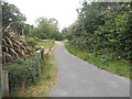
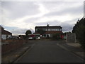
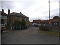


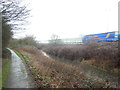


56 photos from this area
Area Information
Key information about the TW19 6AU including its size, population, and administrative classification.
- Area Type
- Postcode
- Area Size
- 1.4 hectares
- Population
- 1431
- Population Density
- 544 people/km²
House Prices in TW19 6AU
28
Properties
£275,679
Average Sold Price
£140,000
Lowest Price
£610,000
Highest Price
Showing 28 properties
| Address | Type | Beds | Baths | Last Sale Price | Last Sale Date | |
|---|---|---|---|---|---|---|
| 153 Hithermoor Road, Stanwell Moor, TW19 6AU | Detached | 4 | 2 | £610,000 | Jun 2025 | |
| 139 Hithermoor Road, Stanwell Moor, TW19 6AU | house | - | - | £387,500 | Sep 2021 | |
| 123 Hithermoor Road, Stanwell Moor, TW19 6AU | Terraced | 3 | - | £328,000 | Feb 2019 | |
| 135 Hithermoor Road, Stanwell Moor, TW19 6AU | house | - | - | £350,000 | Jun 2016 | |
| 133 Hithermoor Road, Stanwell Moor, TW19 6AU | Terraced | - | - | £315,000 | Nov 2015 | |
| 125 Hithermoor Road, Stanwell Moor, TW19 6AU | Terraced | 3 | - | £320,000 | Aug 2015 | |
| 141 Hithermoor Road, Stanwell Moor, TW19 6AU | Terraced | 4 | 1 | £278,000 | Jul 2013 | |
| 169 Hithermoor Road, Stanwell Moor, TW19 6AU | house | - | - | £195,000 | Mar 2006 | |
| 127 Hithermoor Road, Stanwell Moor, TW19 6AU | Terraced | - | - | £240,000 | Dec 2005 | |
| 167 Hithermoor Road, Stanwell Moor, TW19 6AU | Terraced | - | - | £172,000 | Oct 2003 |
Page 1 of 3
Energy Efficiency in TW19 6AU
Amenities
Schools
| Rank | School | Type | Entry gender | Ages |
|---|
Explore more schools in this area
Go to Schools tabDemographics
Household Size
Family (3-5 people)
most common
Accommodation Type
Houses
most common
Tenure
70
majority
Ethnic Group
White
most common
Religion
N/A
most common
Household Composition
N/A
most common
Age
47
median
Adults (30-64 years)
most common
Household Deprivation
N/A
with no deprivation
NS-SEC
32
in Lower managerial occupations
Explore more demographic insights in this area
Go to Demographics tabPlanning
Planning Constraints
- Flood RiskPremium
- Ramsar Wetland SitesPremium
- Area of Outstanding Natural BeautyPremium
- Protected Nature ReservePremium
- Protected WoodlandPremium