Area Overview for TW19 6AR
Photos of TW19 6AR


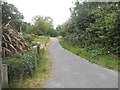

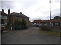


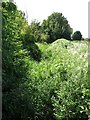
56 photos from this area
Area Information
Key information about the TW19 6AR including its size, population, and administrative classification.
- Area Type
- Postcode
- Area Size
- 18.8 hectares
- Population
- 1431
- Population Density
- 544 people/km²
House Prices in TW19 6AR
24
Properties
£344,353
Average Sold Price
£79,000
Lowest Price
£467,000
Highest Price
Showing 24 properties
| Address | Type | Beds | Baths | Last Sale Price | Last Sale Date | |
|---|---|---|---|---|---|---|
| 65 Hithermoor Road, Stanwell Moor, TW19 6AR | Terraced | 3 | 1 | £467,000 | Sep 2025 | |
| 61 Hithermoor Road, Stanwell Moor, TW19 6AR | Bungalow | 2 | 1 | £420,000 | Dec 2024 | |
| 59 Hithermoor Road, Stanwell Moor, TW19 6AR | Bungalow | 2 | 1 | £445,000 | Oct 2024 | |
| 75 Hithermoor Road, Stanwell Moor, TW19 6AR | Semi-detached | 3 | 1 | £460,000 | Jul 2024 | |
| 83 Hithermoor Road, Stanwell Moor, TW19 6AR | Terraced | 3 | 1 | £400,000 | Jun 2024 | |
| 67 Hithermoor Road, Stanwell Moor, TW19 6AR | Terraced | 3 | 1 | £425,000 | Feb 2024 | |
| 55 Hithermoor Road, Stanwell Moor, TW19 6AR | Semi-detached | 3 | 1 | £450,000 | Apr 2021 | |
| 63 Hithermoor Road, Stanwell Moor, TW19 6AR | house | - | - | £427,500 | Dec 2019 | |
| 79 Hithermoor Road, Stanwell Moor, TW19 6AR | house | 3 | 1 | £372,500 | Jan 2019 | |
| 47 Hithermoor Road, Stanwell Moor, TW19 6AR | Land | 3 | - | £388,000 | May 2018 |
Page 1 of 3
Energy Efficiency in TW19 6AR
Amenities
Schools
| Rank | School | Type | Entry gender | Ages |
|---|
Explore more schools in this area
Go to Schools tabDemographics
Household Size
Family (3-5 people)
most common
Accommodation Type
Houses
most common
Tenure
70
majority
Ethnic Group
White
most common
Religion
N/A
most common
Household Composition
N/A
most common
Age
47
median
Adults (30-64 years)
most common
Household Deprivation
N/A
with no deprivation
NS-SEC
32
in Lower managerial occupations
Explore more demographic insights in this area
Go to Demographics tabPlanning
Planning Constraints
- Flood RiskPremium
- Ramsar Wetland SitesPremium
- Area of Outstanding Natural BeautyPremium
- Protected Nature ReservePremium
- Protected WoodlandPremium