Area Overview for TW15 2ND
Photos of TW15 2ND
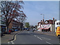
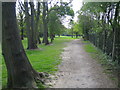
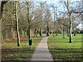
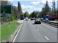
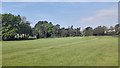
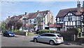
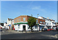
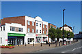
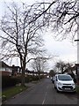
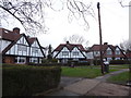
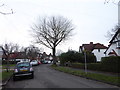
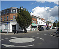
39 photos from this area
Area Information
Key information about the TW15 2ND including its size, population, and administrative classification.
- Area Type
- Postcode
- Area Size
- 1.3 hectares
- Population
- 1331
- Population Density
- 7202 people/km²
House Prices in TW15 2ND
43
Properties
£373,403
Average Sold Price
£71,000
Lowest Price
£615,000
Highest Price
Showing 43 properties
| Address | Type | Beds | Baths | Last Sale Price | Last Sale Date | |
|---|---|---|---|---|---|---|
| 62 Chesterfield Road, Ashford, TW15 2ND | Maisonette | 2 | 1 | £325,000 | Sep 2024 | |
| 92 Chesterfield Road, Ashford, TW15 2ND | house | 2 | 1 | £435,000 | Oct 2022 | |
| 78 Chesterfield Road, Ashford, TW15 2ND | Retail | 3 | 1 | £505,000 | Mar 2022 | |
| 56 Chesterfield Road, Ashford, TW15 2ND | house | 4 | 2 | £615,000 | Feb 2022 | |
| 88 Chesterfield Road, Ashford, TW15 2ND | Semi-detached | 3 | 1 | £415,000 | Feb 2021 | |
| 118 Chesterfield Road, Ashford, TW15 2ND | house | - | - | £458,500 | Jan 2021 | |
| 100 Chesterfield Road, Ashford, TW15 2ND | Semi-detached | 4 | 3 | £596,000 | Aug 2020 | |
| 68 Chesterfield Road, Ashford, TW15 2ND | Semi-detached | 3 | - | £415,000 | Jul 2020 | |
| 114 Chesterfield Road, Ashford, TW15 2ND | Detached | 4 | 2 | £586,000 | Mar 2020 | |
| 60 Chesterfield Road, Ashford, TW15 2ND | Maisonette | 2 | 1 | £320,000 | Jan 2020 |
Page 1 of 5
Energy Efficiency in TW15 2ND
Amenities
Schools
| Rank | School | Type | Entry gender | Ages |
|---|
Explore more schools in this area
Go to Schools tabDemographics
Household Size
Family (3-5 people)
most common
Accommodation Type
Houses
most common
Tenure
81
majority
Ethnic Group
White
most common
Religion
N/A
most common
Household Composition
N/A
most common
Age
47
median
Adults (30-64 years)
most common
Household Deprivation
N/A
with no deprivation
NS-SEC
40
in Lower managerial occupations
Explore more demographic insights in this area
Go to Demographics tabPlanning
Planning Constraints
- Flood RiskPremium
- Ramsar Wetland SitesPremium
- Area of Outstanding Natural BeautyPremium
- Protected Nature ReservePremium
- Protected WoodlandPremium