Area Overview for TW15 2NB
Photos of TW15 2NB
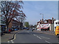
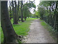
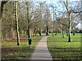

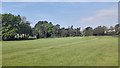
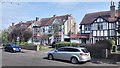
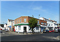
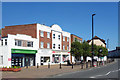
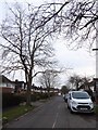
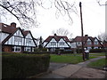
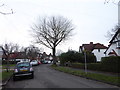
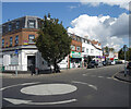
39 photos from this area
Area Information
Key information about the TW15 2NB including its size, population, and administrative classification.
- Area Type
- Postcode
- Area Size
- 6725 m²
- Population
- 1331
- Population Density
- 7202 people/km²
House Prices in TW15 2NB
16
Properties
£443,600
Average Sold Price
£173,000
Lowest Price
£577,000
Highest Price
Showing 16 properties
| Address | Type | Beds | Baths | Last Sale Price | Last Sale Date | |
|---|---|---|---|---|---|---|
| 15 Chesterfield Road, Ashford, TW15 2NB | Detached | - | - | £577,000 | Sep 2023 | |
| 50 Chesterfield Road, Ashford, TW15 2NB | Detached | 3 | 2 | £490,000 | Mar 2022 | |
| 48 Chesterfield Road, Ashford, TW15 2NB | house | - | - | £555,000 | Dec 2021 | |
| 42 Chesterfield Road, Ashford, TW15 2NB | Semi-detached | 3 | 1 | £473,000 | Jun 2021 | |
| 7 Chesterfield Road, Ashford, TW15 2NB | Semi-detached | 2 | - | £460,000 | Mar 2019 | |
| 36 Chesterfield Road, Ashford, TW15 2NB | Semi-detached | 3 | - | £472,500 | Aug 2017 | |
| 5 Chesterfield Road, Ashford, TW15 2NB | Bungalow | 3 | 1 | £435,000 | Nov 2016 | |
| 52 Chesterfield Road, Ashford, TW15 2NB | house | 4 | - | £555,000 | May 2015 | |
| 9 Chesterfield Road, Ashford, TW15 2NB | Detached | 3 | - | £383,900 | Apr 2014 | |
| 34 Chesterfield Road, Ashford, TW15 2NB | house | - | - | £305,199 | Sep 2009 |
Page 1 of 2
Energy Efficiency in TW15 2NB
Amenities
Schools
| Rank | School | Type | Entry gender | Ages |
|---|
Explore more schools in this area
Go to Schools tabDemographics
Household Size
Family (3-5 people)
most common
Accommodation Type
Houses
most common
Tenure
81
majority
Ethnic Group
White
most common
Religion
N/A
most common
Household Composition
N/A
most common
Age
47
median
Adults (30-64 years)
most common
Household Deprivation
N/A
with no deprivation
NS-SEC
40
in Lower managerial occupations
Explore more demographic insights in this area
Go to Demographics tabPlanning
Planning Constraints
- Flood RiskPremium
- Ramsar Wetland SitesPremium
- Area of Outstanding Natural BeautyPremium
- Protected Nature ReservePremium
- Protected WoodlandPremium