Area Overview for TN37 7NJ
Photos of TN37 7NJ

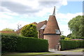

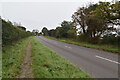
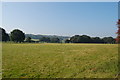
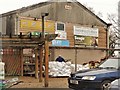
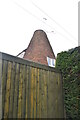
11 photos from this area
Area Information
Key information about the TN37 7NJ including its size, population, and administrative classification.
- Area Type
- Postcode
- Area Size
- 15.7 hectares
- Population
- 1920
- Population Density
- 52 people/km²
House Prices in TN37 7NJ
25
Properties
£336,435
Average Sold Price
£134,000
Lowest Price
£757,000
Highest Price
Showing 25 properties
| Address | Type | Beds | Baths | Last Sale Price | Last Sale Date | |
|---|---|---|---|---|---|---|
| Fyfield, 48 Baldslow Down, Westfield, TN37 7NJ | Detached | 4 | 3 | £757,000 | Jul 2024 | |
| Gnomes Wood, 43 Baldslow Down, Westfield, TN37 7NJ | house | - | - | £529,750 | May 2021 | |
| Baronsmede, 36 Baldslow Down, Westfield, TN37 7NJ | house | - | - | £450,000 | Jan 2021 | |
| Gipsely, 24 Baldslow Down, Westfield, TN37 7NJ | Detached | 5 | 1 | £475,000 | Apr 2020 | |
| Welbeck House, 32 Baldslow Down, Westfield, TN37 7NJ | Detached | 4 | 1 | £375,000 | May 2017 | |
| 47 Baldslow Down, Westfield, TN37 7NJ | house | - | - | £350,000 | Jul 2011 | |
| 41 Baldslow Down, Westfield, TN37 7NJ | Detached | - | - | £315,000 | Jun 2009 | |
| Astolat, 42 Baldslow Down, Westfield, TN37 7NJ | Detached | - | - | £140,300 | Jul 2006 | |
| Tanglewood, 35 Baldslow Down, Westfield, TN37 7NJ | house | - | - | £250,000 | Aug 2003 | |
| Kiah, 26 Baldslow Down, Westfield, TN37 7NJ | Detached | - | - | £210,000 | Aug 2002 |
Page 1 of 3
Energy Efficiency in TN37 7NJ
Amenities
Schools
| Rank | School | Type | Entry gender | Ages |
|---|
Explore more schools in this area
Go to Schools tabDemographics
Household Size
Two person
most common
Accommodation Type
Houses
most common
Tenure
86
majority
Ethnic Group
White
most common
Religion
N/A
most common
Household Composition
N/A
most common
Age
47
median
Adults (30-64 years)
most common
Household Deprivation
N/A
with no deprivation
NS-SEC
40
in Lower managerial occupations
Explore more demographic insights in this area
Go to Demographics tabPlanning
Planning Constraints
- Flood RiskPremium
- Ramsar Wetland SitesPremium
- Area of Outstanding Natural BeautyPremium
- Protected Nature ReservePremium
- Protected WoodlandPremium