Area Overview for TN33 9JU
Photos of TN33 9JU
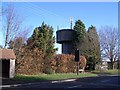


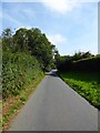
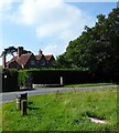


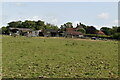
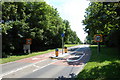
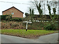
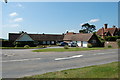
36 photos from this area
Area Information
Key information about the TN33 9JU including its size, population, and administrative classification.
- Area Type
- Postcode
- Area Size
- 8.6 hectares
- Population
- 1220
- Population Density
- 48 people/km²
House Prices in TN33 9JU
13
Properties
£459,328
Average Sold Price
£335,000
Lowest Price
£595,000
Highest Price
Showing 13 properties
| Address | Type | Beds | Baths | Last Sale Price | Last Sale Date | |
|---|---|---|---|---|---|---|
| Rushmere, Standard Hill, Ninfield, TN33 9JU | Bungalow | 2 | 1 | £520,000 | Dec 2023 | |
| The Maltings, Standard Hill, Ninfield, TN33 9JU | Semi-detached | 3 | 2 | £595,000 | Oct 2023 | |
| Hive Cottage, Standard Hill, Ninfield, TN33 9JU | Bungalow | - | - | £595,000 | May 2022 | |
| Saltoun, Standard Hill, Ninfield, TN33 9JU | Bungalow | 3 | 2 | £392,500 | Apr 2020 | |
| 1, Standard Hill Cottages, Standard Hill, Ninfield, TN33 9JU | Semi-detached | 4 | 1 | £362,500 | Sep 2019 | |
| Karibu, Standard Hill, Ninfield, TN33 9JU | Bungalow | 3 | 2 | £460,000 | Feb 2019 | |
| The Millstone, Standard Hill, Ninfield, TN33 9JU | Detached | 5 | 3 | £480,000 | Sep 2018 | |
| Third Acre, Standard Hill, Ninfield, TN33 9JU | Bungalow | - | - | £335,000 | Apr 2016 | |
| Barn Cottage, Standard Hill, Ninfield, TN33 9JU | Bungalow | 2 | 2 | £393,950 | Jun 2010 | |
| Campions, Standard Hill, Ninfield, TN33 9JU | Detached | - | - | - | - |
Page 1 of 2
Energy Efficiency in TN33 9JU
Amenities
Schools
| Rank | School | Type | Entry gender | Ages |
|---|
Explore more schools in this area
Go to Schools tabDemographics
Household Size
Two person
most common
Accommodation Type
Houses
most common
Tenure
85
majority
Ethnic Group
White
most common
Religion
N/A
most common
Household Composition
N/A
most common
Age
47
median
Adults (30-64 years)
most common
Household Deprivation
N/A
with no deprivation
NS-SEC
40
in Lower managerial occupations
Explore more demographic insights in this area
Go to Demographics tabPlanning
Planning Constraints
- Flood RiskPremium
- Ramsar Wetland SitesPremium
- Area of Outstanding Natural BeautyPremium
- Protected Nature ReservePremium
- Protected WoodlandPremium