Area Overview for TN33 0DE
Photos of TN33 0DE
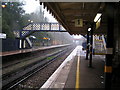
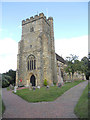
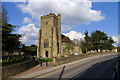
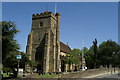
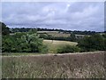
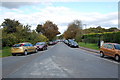
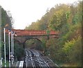
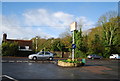
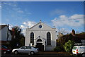
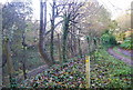
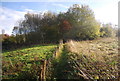
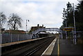
100 photos from this area
Area Information
Key information about the TN33 0DE including its size, population, and administrative classification.
- Area Type
- Postcode
- Area Size
- 2.8 hectares
- Population
- 1690
- Population Density
- 278 people/km²
House Prices in TN33 0DE
9
Properties
£205,000
Average Sold Price
£185,000
Lowest Price
£225,000
Highest Price
Showing 9 properties
| Address | Type | Beds | Baths | Last Sale Price | Last Sale Date | |
|---|---|---|---|---|---|---|
| 1, Granary Cottages, Station Road, Battle, TN33 0DE | house | - | - | £225,000 | Oct 2014 | |
| 2, Granary Cottages, Station Road, Battle, TN33 0DE | house | 2 | - | £185,000 | Apr 2011 | |
| Battle Mowers Service Centre, The Warehouse, Station Road, Battle, TN33 0DE | Industrial | - | - | - | - | |
| Flat At, Robins Yard, Station Road, Battle, TN33 0DE | Flat | - | - | - | - | |
| Unit 999, Station Road, Battle, TN33 0DE | Office | - | - | - | - | |
| Blackmans Coalyard, Station Road, Battle, TN33 0DE | Industrial | - | - | - | - | |
| Battle Paving, Station Road, Battle, TN33 0DE | Industrial | - | - | - | - | |
| Old Station House, Station Road, Battle, TN33 0DE | Office | - | - | - | - | |
| Connex South Eastern, Battle Railway Station, Station Road, Battle, TN33 0DE | office_workshop | - | - | - | - |
Energy Efficiency in TN33 0DE
Amenities
Schools
| Rank | School | Type | Entry gender | Ages |
|---|
Explore more schools in this area
Go to Schools tabDemographics
Household Size
Two person
most common
Accommodation Type
Houses
most common
Tenure
79
majority
Ethnic Group
White
most common
Religion
N/A
most common
Household Composition
N/A
most common
Age
47
median
Adults (30-64 years)
most common
Household Deprivation
N/A
with no deprivation
NS-SEC
43
in Lower managerial occupations
Explore more demographic insights in this area
Go to Demographics tabPlanning
Planning Constraints
- Flood RiskPremium
- Ramsar Wetland SitesPremium
- Area of Outstanding Natural BeautyPremium
- Protected Nature ReservePremium
- Protected WoodlandPremium