Area Overview for TN22 5DE
Photos of TN22 5DE
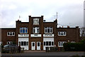
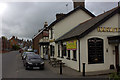
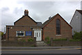
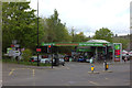
100 photos from this area
Area Information
Key information about the TN22 5DE including its size, population, and administrative classification.
- Area Type
- Postcode
- Area Size
- 1.2 hectares
- Population
- 1293
- Population Density
- 1741 people/km²
House Prices in TN22 5DE
51
Properties
£340,167
Average Sold Price
£88,000
Lowest Price
£810,000
Highest Price
Showing 51 properties
| Address | Type | Beds | Baths | Last Sale Price | Last Sale Date | |
|---|---|---|---|---|---|---|
| 66 New Town, Uckfield, TN22 5DE | Semi-detached | 3 | 1 | £306,000 | Jun 2021 | |
| Apple Tree Cottage, 60 New Town, Uckfield, TN22 5DE | Terraced | 3 | 2 | £317,500 | Nov 2020 | |
| Lewes House, New Town, Uckfield, TN22 5DE | Detached | - | - | £750,000 | Nov 2020 | |
| 46 New Town, Uckfield, TN22 5DE | Detached | 5 | 3 | £810,000 | Oct 2020 | |
| Amadour, New Town, Uckfield, TN22 5DE | Semi-detached | 3 | 1 | £390,000 | Oct 2019 | |
| 68 New Town, Uckfield, TN22 5DE | Maisonette | 2 | 1 | £228,000 | Aug 2018 | |
| 62 New Town, Uckfield, TN22 5DE | house | - | - | £237,500 | Nov 2013 | |
| Flat 3, The Oasthouse, 54A New Town, Uckfield, TN22 5DE | house | - | - | £110,000 | Oct 2011 | |
| The Granary, New Town, Uckfield, TN22 5DE | Detached | 4 | 3 | £175,000 | Jun 2010 | |
| 44 New Town, Uckfield, TN22 5DE | Semi-detached | - | - | £315,000 | Sep 2007 |
Page 1 of 6
Energy Efficiency in TN22 5DE
Amenities
Schools
| Rank | School | Type | Entry gender | Ages |
|---|
Explore more schools in this area
Go to Schools tabDemographics
Household Size
Two person
most common
Accommodation Type
Houses
most common
Tenure
70
majority
Ethnic Group
White
most common
Religion
N/A
most common
Household Composition
N/A
most common
Age
47
median
Adults (30-64 years)
most common
Household Deprivation
N/A
with no deprivation
NS-SEC
35
in Lower managerial occupations
Explore more demographic insights in this area
Go to Demographics tabPlanning
Planning Constraints
- Flood RiskPremium
- Ramsar Wetland SitesPremium
- Area of Outstanding Natural BeautyPremium
- Protected Nature ReservePremium
- Protected WoodlandPremium