Area Overview for TN22 4PA
Photos of TN22 4PA
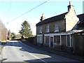
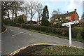
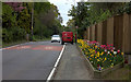

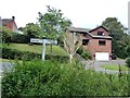
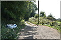
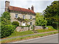
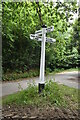
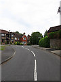
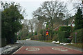
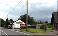
44 photos from this area
Area Information
Key information about the TN22 4PA including its size, population, and administrative classification.
- Area Type
- Postcode
- Area Size
- 9.0 hectares
- Population
- 1713
- Population Density
- 112 people/km²
House Prices in TN22 4PA
16
Properties
£532,909
Average Sold Price
£200,000
Lowest Price
£739,000
Highest Price
Showing 16 properties
| Address | Type | Beds | Baths | Last Sale Price | Last Sale Date | |
|---|---|---|---|---|---|---|
| Garden Cottage, Limes Lane, Buxted, TN22 4PA | Detached | 3 | 1 | £695,000 | Feb 2023 | |
| Minerva, Limes Lane, Buxted, TN22 4PA | Retail | 3 | 1 | £600,000 | Oct 2022 | |
| Ashdown, Limes Lane, Buxted, TN22 4PA | Detached | 4 | 3 | £715,000 | Jun 2021 | |
| The Limes, Limes Lane, Buxted, TN22 4PA | Detached | 4 | 3 | £715,000 | May 2021 | |
| Fairbank, Limes Lane, Buxted, TN22 4PA | Bungalow | 3 | 1 | £488,000 | Dec 2019 | |
| Hightrees, Limes Lane, Buxted, TN22 4PA | house | - | - | £675,000 | Apr 2017 | |
| Friarswood, Limes Lane, Buxted, TN22 4PA | Detached | 5 | 2 | £739,000 | Nov 2010 | |
| Corner Croft, Limes Lane, Buxted, TN22 4PA | Detached | - | - | £475,000 | Jun 2007 | |
| The Haven, Limes Lane, Buxted, TN22 4PA | Detached | - | - | £295,000 | Apr 2006 | |
| Limes Cottage, Limes Lane, Buxted, TN22 4PA | Detached | - | - | £265,001 | May 2001 |
Page 1 of 2
Energy Efficiency in TN22 4PA
Amenities
Schools
| Rank | School | Type | Entry gender | Ages |
|---|
Explore more schools in this area
Go to Schools tabDemographics
Household Size
Two person
most common
Accommodation Type
Houses
most common
Tenure
89
majority
Ethnic Group
White
most common
Religion
N/A
most common
Household Composition
N/A
most common
Age
47
median
Adults (30-64 years)
most common
Household Deprivation
N/A
with no deprivation
NS-SEC
51
in Lower managerial occupations
Explore more demographic insights in this area
Go to Demographics tabPlanning
Planning Constraints
- Flood RiskPremium
- Ramsar Wetland SitesPremium
- Area of Outstanding Natural BeautyPremium
- Protected Nature ReservePremium
- Protected WoodlandPremium