Area Overview for TN21 8AD
Photos of TN21 8AD
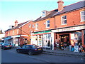
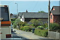

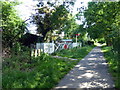

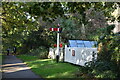

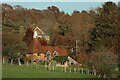
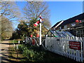
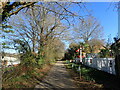
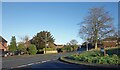
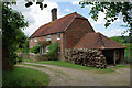
49 photos from this area
Area Information
Key information about the TN21 8AD including its size, population, and administrative classification.
- Area Type
- Postcode
- Area Size
- 6985 m²
- Population
- 1709
- Population Density
- 5204 people/km²
House Prices in TN21 8AD
24
Properties
£243,167
Average Sold Price
£72,000
Lowest Price
£350,000
Highest Price
Showing 24 properties
| Address | Type | Beds | Baths | Last Sale Price | Last Sale Date | |
|---|---|---|---|---|---|---|
| Hillview, Hailsham Road, Heathfield, TN21 8AD | Semi-detached | 3 | 1 | £260,000 | Sep 2024 | |
| Silverdale, Hailsham Road, Heathfield, TN21 8AD | Semi-detached | 4 | 2 | £350,000 | Mar 2021 | |
| Goldstone, Hailsham Road, Heathfield, TN21 8AD | Semi-detached | 4 | - | £270,000 | Dec 2018 | |
| Whiteoaks, Hailsham Road, Heathfield, TN21 8AD | house | - | - | £235,000 | Feb 2010 | |
| Derby House, Hailsham Road, Heathfield, TN21 8AD | house | - | - | £272,000 | Jul 2007 | |
| Beaconsfield, Hailsham Road, Heathfield, TN21 8AD | Terraced | 3 | 1 | £72,000 | Dec 1996 | |
| Galsworthy, Hailsham Road, Heathfield, TN21 8AD | Terraced | 3 | 1 | - | - | |
| Staff Accomodation, Chimneys, Hailsham Road, Heathfield, TN21 8AD | Semi-detached | 3 | 1 | - | - | |
| Flat 5, Brook House, Hailsham Road, Heathfield, TN21 8AD | Flat | 1 | 1 | - | - | |
| Flat 4, Commerce House, Hailsham Road, Heathfield, TN21 8AD | Flat | 2 | - | - | - |
Page 1 of 3
Energy Efficiency in TN21 8AD
Amenities
Schools
| Rank | School | Type | Entry gender | Ages |
|---|
Explore more schools in this area
Go to Schools tabDemographics
Household Size
Family (3-5 people)
most common
Accommodation Type
Houses
most common
Tenure
86
majority
Ethnic Group
White
most common
Religion
N/A
most common
Household Composition
N/A
most common
Age
47
median
Adults (30-64 years)
most common
Household Deprivation
N/A
with no deprivation
NS-SEC
38
in Lower managerial occupations
Explore more demographic insights in this area
Go to Demographics tabPlanning
Planning Constraints
- Flood RiskPremium
- Ramsar Wetland SitesPremium
- Area of Outstanding Natural BeautyPremium
- Protected Nature ReservePremium
- Protected WoodlandPremium