Area Overview for TN19 7NB
Photos of TN19 7NB

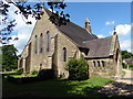

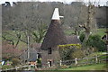
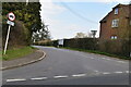
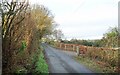
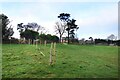
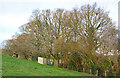
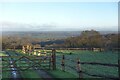
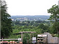
41 photos from this area
Area Information
Key information about the TN19 7NB including its size, population, and administrative classification.
- Area Type
- Postcode
- Area Size
- 20.7 hectares
- Population
- 1706
- Population Density
- 39 people/km²
House Prices in TN19 7NB
21
Properties
£403,727
Average Sold Price
£75,000
Lowest Price
£706,000
Highest Price
Showing 21 properties
| Address | Type | Beds | Baths | Last Sale Price | Last Sale Date | |
|---|---|---|---|---|---|---|
| Crohamhurst, Heathfield Road, Burwash Common, TN19 7NB | Semi-detached | 3 | 2 | £412,000 | Dec 2024 | |
| Thorntonville, Heathfield Road, Burwash Common, TN19 7NB | Semi-detached | 3 | 1 | £360,000 | Jul 2024 | |
| Oak Cottage, Heathfield Road, Burwash Common, TN19 7NB | house | - | - | £600,000 | Jul 2022 | |
| Clover Leys Farmhouse, Heathfield Road, Burwash Common, TN19 7NB | Detached | 4 | 2 | £706,000 | Feb 2021 | |
| Shepherds Mead, Heathfield Road, Burwash Common, TN19 7NB | Semi-detached | 4 | 2 | £545,000 | Mar 2020 | |
| Doels Farm, Heathfield Road, Burwash Common, TN19 7NB | Detached | 3 | 2 | £487,500 | Oct 2018 | |
| Clymshurst, Heathfield Road, Burwash Common, TN19 7NB | house | - | - | £615,001 | Jan 2017 | |
| Old Climshurst, Heathfield Road, Burwash Common, TN19 7NB | Cottage | 2 | - | £485,000 | Mar 2016 | |
| Brights Cottage, Heathfield Road, Burwash Common, TN19 7NB | house | 3 | - | £399,950 | Jun 2012 | |
| Wisteria, Heathfield Road, Burwash Common, TN19 7NB | house | 3 | - | £240,000 | Sep 2010 |
Page 1 of 3
Energy Efficiency in TN19 7NB
Amenities
Schools
| Rank | School | Type | Entry gender | Ages |
|---|
Explore more schools in this area
Go to Schools tabDemographics
Household Size
Two person
most common
Accommodation Type
Houses
most common
Tenure
84
majority
Ethnic Group
White
most common
Religion
N/A
most common
Household Composition
N/A
most common
Age
47
median
Adults (30-64 years)
most common
Household Deprivation
N/A
with no deprivation
NS-SEC
44
in Lower managerial occupations
Explore more demographic insights in this area
Go to Demographics tabPlanning
Planning Constraints
- Flood RiskPremium
- Ramsar Wetland SitesPremium
- Area of Outstanding Natural BeautyPremium
- Protected Nature ReservePremium
- Protected WoodlandPremium