Area Overview for TN19 7LS
Photos of TN19 7LS
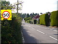
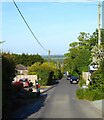
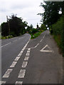
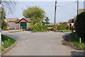
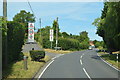
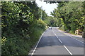
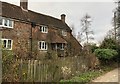
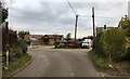
58 photos from this area
Area Information
Key information about the TN19 7LS including its size, population, and administrative classification.
- Area Type
- Postcode
- Area Size
- 1.8 hectares
- Population
- 1706
- Population Density
- 39 people/km²
House Prices in TN19 7LS
8
Properties
£458,143
Average Sold Price
£105,000
Lowest Price
£670,000
Highest Price
Showing 8 properties
| Address | Type | Beds | Baths | Last Sale Price | Last Sale Date | |
|---|---|---|---|---|---|---|
| Cherry Trees, Vicarage Road, Burwash Common, TN19 7LS | Bungalow | 3 | 3 | £460,000 | Aug 2023 | |
| Rosewood, Vicarage Road, Burwash Common, TN19 7LS | Bungalow | 3 | - | £670,000 | Jan 2023 | |
| Hollow Tree, Vicarage Road, Burwash Common, TN19 7LS | Bungalow | - | - | £455,000 | Feb 2021 | |
| Chariden, Vicarage Road, Burwash Common, TN19 7LS | Bungalow | 3 | 2 | £435,000 | Dec 2020 | |
| Linkway, Vicarage Road, Burwash Common, TN19 7LS | Detached | 3 | 2 | £587,000 | Jan 2020 | |
| Badgers Ruff, Vicarage Road, Burwash Common, TN19 7LS | Detached | 4 | 3 | £495,000 | Sep 2017 | |
| Pin Tor, Vicarage Road, Burwash Common, TN19 7LS | Detached | 4 | - | £105,000 | Aug 1997 | |
| Robins, Vicarage Road, Burwash Common, TN19 7LS | Detached | - | - | - | - |
Energy Efficiency in TN19 7LS
Amenities
Schools
| Rank | School | Type | Entry gender | Ages |
|---|
Explore more schools in this area
Go to Schools tabDemographics
Household Size
Two person
most common
Accommodation Type
Houses
most common
Tenure
84
majority
Ethnic Group
White
most common
Religion
N/A
most common
Household Composition
N/A
most common
Age
47
median
Adults (30-64 years)
most common
Household Deprivation
N/A
with no deprivation
NS-SEC
44
in Lower managerial occupations
Explore more demographic insights in this area
Go to Demographics tabPlanning
Planning Constraints
- Flood RiskPremium
- Ramsar Wetland SitesPremium
- Area of Outstanding Natural BeautyPremium
- Protected Nature ReservePremium
- Protected WoodlandPremium