Area Overview for TN18 4NE
Photos of TN18 4NE
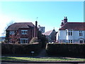
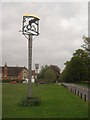
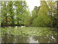
100 photos from this area
Area Information
Key information about the TN18 4NE including its size, population, and administrative classification.
- Area Type
- Postcode
- Area Size
- 3.1 hectares
- Population
- 1605
- Population Density
- 320 people/km²
House Prices in TN18 4NE
9
Properties
£470,688
Average Sold Price
£67,000
Lowest Price
£1,000,000
Highest Price
Showing 9 properties
| Address | Type | Beds | Baths | Last Sale Price | Last Sale Date | |
|---|---|---|---|---|---|---|
| Moor Lodge, Talbot Road, Hawkhurst, Cranbrook, TN18 4NE | house | 5 | 3 | £1,000,000 | Jan 2025 | |
| Hensil Barn, Talbot Road, Hawkhurst, Cranbrook, TN18 4NE | Detached | 4 | - | £950,000 | May 2021 | |
| Whites Cottage, Talbot Road, Hawkhurst, Cranbrook, TN18 4NE | Detached | 3 | 1 | £595,000 | Dec 2020 | |
| Highton, Talbot Road, Hawkhurst, Cranbrook, TN18 4NE | house | - | - | £240,000 | Jun 2012 | |
| The Rockery, Talbot Road, Hawkhurst, Cranbrook, TN18 4NE | Detached | - | - | £540,000 | Jul 2009 | |
| Bramwyn, Talbot Road, Hawkhurst, Cranbrook, TN18 4NE | house | - | - | £186,000 | Apr 2007 | |
| Jocia, Talbot Road, Hawkhurst, Cranbrook, TN18 4NE | Semi-detached | - | - | £187,500 | Feb 2007 | |
| Goodison, Talbot Road, Hawkhurst, Cranbrook, TN18 4NE | Semi-detached | - | - | £67,000 | Oct 1996 | |
| Alicante, Talbot Road, Hawkhurst, Cranbrook, TN18 4NE | Detached | 5 | 3 | - | - |
Energy Efficiency in TN18 4NE
Amenities
Schools
| Rank | School | Type | Entry gender | Ages |
|---|
Explore more schools in this area
Go to Schools tabDemographics
Household Size
One person
most common
Accommodation Type
Houses
most common
Tenure
56
majority
Ethnic Group
White
most common
Religion
N/A
most common
Household Composition
N/A
most common
Age
47
median
Adults (30-64 years)
most common
Household Deprivation
N/A
with no deprivation
NS-SEC
34
in Lower managerial occupations
Explore more demographic insights in this area
Go to Demographics tabPlanning
Planning Constraints
- Flood RiskPremium
- Ramsar Wetland SitesPremium
- Area of Outstanding Natural BeautyPremium
- Protected Nature ReservePremium
- Protected WoodlandPremium