Area Overview for TN18 4QH
Photos of TN18 4QH
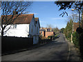


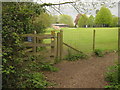
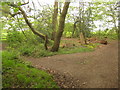
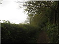

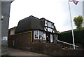
67 photos from this area
Area Information
Key information about the TN18 4QH including its size, population, and administrative classification.
- Area Type
- Postcode
- Area Size
- 37.3 hectares
- Population
- 1605
- Population Density
- 320 people/km²
House Prices in TN18 4QH
9
Properties
£733,835
Average Sold Price
£411,505
Lowest Price
£1,075,000
Highest Price
Showing 9 properties
| Address | Type | Beds | Baths | Last Sale Price | Last Sale Date | |
|---|---|---|---|---|---|---|
| April Cottage, Hensil Lane, Hawkhurst, Cranbrook, TN18 4QH | Detached | 4 | 2 | £715,000 | Jul 2024 | |
| Rowland Farm, Hensil Lane, Hawkhurst, Cranbrook, TN18 4QH | house | - | - | £1,075,000 | Mar 2021 | |
| Mulberry House, Hensil Lane, Hawkhurst, Cranbrook, TN18 4QH | Bungalow | 3 | - | £411,505 | Dec 2015 | |
| Hensill House, Hensil Lane, Hawkhurst, Cranbrook, TN18 4QH | Detached | 7 | 3 | - | - | |
| Lodge Cottage, Hensil Lane, Hawkhurst, Cranbrook, TN18 4QH | Detached | - | - | - | - | |
| Cedar Gables, Hensil Lane, Hawkhurst, Cranbrook, TN18 4QH | Detached | - | - | - | - | |
| Hensill Stables, Hensil Lane, Hawkhurst, Cranbrook, TN18 4QH | house | - | - | - | - | |
| The Garage Flat, Hensill House, Hensil Lane, Hawkhurst, Cranbrook, TN18 4QH | Flat | - | - | - | - | |
| Tennis 279M From The Hollies, Talbot Road 25M From Unnamed Road, Talbot Road, Hawkhurst, Cranbrook, TN18 4QH | Leisure | - | - | - | - |
Energy Efficiency in TN18 4QH
Amenities
Schools
| Rank | School | Type | Entry gender | Ages |
|---|
Explore more schools in this area
Go to Schools tabDemographics
Household Size
One person
most common
Accommodation Type
Houses
most common
Tenure
56
majority
Ethnic Group
White
most common
Religion
N/A
most common
Household Composition
N/A
most common
Age
47
median
Adults (30-64 years)
most common
Household Deprivation
N/A
with no deprivation
NS-SEC
34
in Lower managerial occupations
Explore more demographic insights in this area
Go to Demographics tabPlanning
Planning Constraints
- Flood RiskPremium
- Ramsar Wetland SitesPremium
- Area of Outstanding Natural BeautyPremium
- Protected Nature ReservePremium
- Protected WoodlandPremium